

2015 Fallen Leaf, Tahoe Rim, Flume Trail Loop
A cycling route starting in South Lake Tahoe, California, United States.
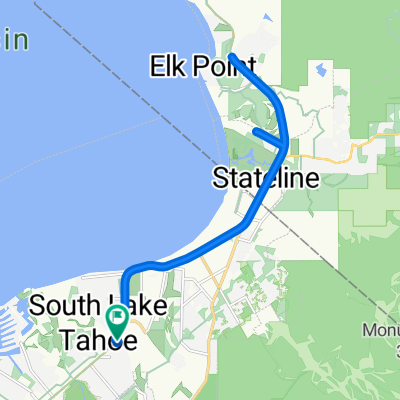
Overview
About this route
Fallen Leaf Lake to Woodfords to Grover Hot Springs to Kingsbury Grade to Tahoe Rim Trail (or Genoa Peak Road) to Spooner Summit To Flume Trail to Marlette Lake to Sand Harbor and back via Highway 50 to FLL.
- -:--
- Duration
- 208.2 km
- Distance
- 2,721 m
- Ascent
- 2,711 m
- Descent
- ---
- Avg. speed
- ---
- Max. altitude

Route quality
Waytypes & surfaces along the route
Waytypes
Road
33.3 km
(16 %)
Path
27.1 km
(13 %)
Surfaces
Paved
149.9 km
(72 %)
Unpaved
41.6 km
(20 %)
Asphalt
145.7 km
(70 %)
Ground
31.2 km
(15 %)
Continue with Bikemap
Use, edit, or download this cycling route
You would like to ride 2015 Fallen Leaf, Tahoe Rim, Flume Trail Loop or customize it for your own trip? Here is what you can do with this Bikemap route:
Free features
- Save this route as favorite or in collections
- Copy & plan your own version of this route
- Split it into stages to create a multi-day tour
- Sync your route with Garmin or Wahoo
Premium features
Free trial for 3 days, or one-time payment. More about Bikemap Premium.
- Navigate this route on iOS & Android
- Export a GPX / KML file of this route
- Create your custom printout (try it for free)
- Download this route for offline navigation
Discover more Premium features.
Get Bikemap PremiumFrom our community
Other popular routes starting in South Lake Tahoe
 Tour of Lake Tahoe 2017
- Distance
- 122.8 km
- Ascent
- 730 m
- Descent
- 730 m
- Location
- South Lake Tahoe, California, United States
 pioneer loop
- Distance
- 25.8 km
- Ascent
- 234 m
- Descent
- 236 m
- Location
- South Lake Tahoe, California, United States
 Easy ride in South Lake Tahoe
- Distance
- 6.2 km
- Ascent
- 28 m
- Descent
- 16 m
- Location
- South Lake Tahoe, California, United States
 Fallen Leaf Loop
- Distance
- 232 km
- Ascent
- 2,760 m
- Descent
- 2,757 m
- Location
- South Lake Tahoe, California, United States
 The Y to Fallen Leaf Lake
- Distance
- 9.9 km
- Ascent
- 129 m
- Descent
- 80 m
- Location
- South Lake Tahoe, California, United States
 South Lake Tahoe tour
- Distance
- 31.8 km
- Ascent
- 330 m
- Descent
- 331 m
- Location
- South Lake Tahoe, California, United States
 elks point out n back
- Distance
- 19.7 km
- Ascent
- 187 m
- Descent
- 187 m
- Location
- South Lake Tahoe, California, United States
 Emigrant Loop
- Distance
- 81.9 km
- Ascent
- 1,296 m
- Descent
- 1,299 m
- Location
- South Lake Tahoe, California, United States
Open it in the app