

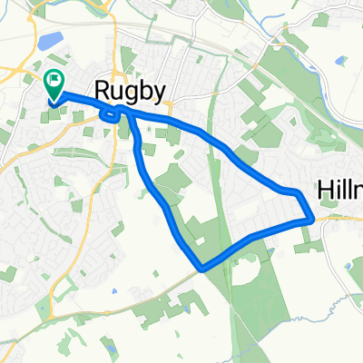
Saturday hilly ride
A cycling route starting in Rugby, England, United Kingdom.
Overview
About this route
<span data-sheets-userformat="[null,null,15167,[null,0],[null,2,15055031],[null,[[null,2,0,null,null,[null,0]],[null,0,0,3],[null,1,0,null,1]]],[null,[[null,2,0,null,null,[null,0]],[null,0,0,3],[null,1,0,null,1]]],[null,[[null,2,0,null,null,[null,0]],[null,0,0,3],[null,1,0,null,1]]],[null,[[null,2,0,null,null,[null,0]],[null,0,0,3],[null,1,0,null,1]]],null,null,0,0,null,[null,2,0],"arial,sans,sans-serif",10]" data-sheets-value="[null,2,"DAY OUT WITH OBG"]" style="font-size:100%;font-family:arial,sans,sans-serif;color:#000000;">Saturday hilly ride</span>
- -:--
- Duration
- 60.6 km
- Distance
- 338 m
- Ascent
- 338 m
- Descent
- ---
- Avg. speed
- ---
- Max. altitude
Route quality
Waytypes & surfaces along the route
Waytypes
Quiet road
27.3 km
(45 %)
Road
26 km
(43 %)
Surfaces
Paved
14.5 km
(24 %)
Asphalt
14.5 km
(24 %)
Undefined
46 km
(76 %)
Continue with Bikemap
Use, edit, or download this cycling route
You would like to ride Saturday hilly ride or customize it for your own trip? Here is what you can do with this Bikemap route:
Free features
- Save this route as favorite or in collections
- Copy & plan your own version of this route
- Sync your route with Garmin or Wahoo
Premium features
Free trial for 3 days, or one-time payment. More about Bikemap Premium.
- Navigate this route on iOS & Android
- Export a GPX / KML file of this route
- Create your custom printout (try it for free)
- Download this route for offline navigation
Discover more Premium features.
Get Bikemap PremiumFrom our community
Other popular routes starting in Rugby
 10 mile
- Distance
- 17.1 km
- Ascent
- 266 m
- Descent
- 273 m
- Location
- Rugby, England, United Kingdom
 Route to 153 Abbey Street, Rugby
- Distance
- 28.4 km
- Ascent
- 1,618 m
- Descent
- 1,610 m
- Location
- Rugby, England, United Kingdom
 10 Mile Loop - Rugby Town Centre, Canal and Great Central Way
- Distance
- 15.8 km
- Ascent
- 60 m
- Descent
- 61 m
- Location
- Rugby, England, United Kingdom
 Draycote Water
- Distance
- 47.8 km
- Ascent
- 239 m
- Descent
- 238 m
- Location
- Rugby, England, United Kingdom
 Pytchley Road 158 to Slade Road 37
- Distance
- 5.6 km
- Ascent
- 137 m
- Descent
- 149 m
- Location
- Rugby, England, United Kingdom
 5mile
5mile- Distance
- 9.1 km
- Ascent
- 120 m
- Descent
- 120 m
- Location
- Rugby, England, United Kingdom
 Saturday hilly ride
- Distance
- 60.6 km
- Ascent
- 338 m
- Descent
- 338 m
- Location
- Rugby, England, United Kingdom
 Crick Cramp
- Distance
- 38.1 km
- Ascent
- 1,132 m
- Descent
- 1,132 m
- Location
- Rugby, England, United Kingdom
Open it in the app