

Day 1
- 122 km
- 1,978 m
- 1,721 m
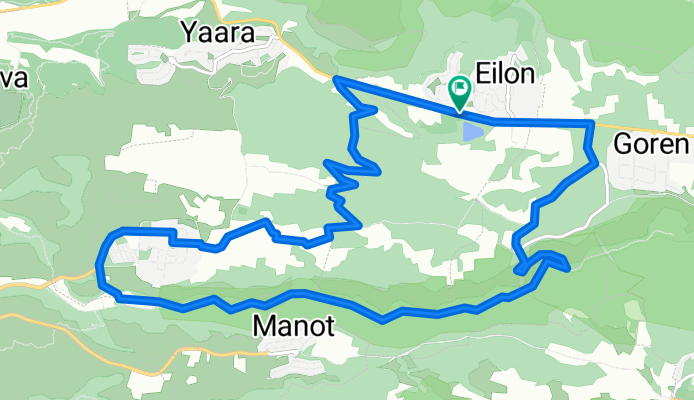
- Mi‘ilyā, Northern District, Israel
A cycling route starting in Mi‘ilyā, Northern District, Israel.
Overview
יציאה ברגל מאילון מערבה ל כביש הצפון. לפני יערה דרומה לאבדון. התחברתעם נחל כזיב. הליהמזרחה במעלה הנחל. עליה לגורן, צפונה לאילון.18.8 ק"מ. 5 שעת טיול. <div style="top: 12px; width: 1px; height: 1px; right: -1000px; overflow: hidden; position: absolute;"> </div>
created this 10 years ago
Continue with Bikemap
You would like to ride אילון..כביש יערה. דרומה לאבדון, ירידה לנחל כזיב, מזרחה חזרה לגורן,עליה צפונה לאילון. 18.8 ק"מ or customize it for your own trip? Here is what you can do with this Bikemap route:
Free trial for 3 days, or one-time payment. More about Bikemap Premium.
Discover more Premium features.
Get Bikemap PremiumFrom our community
Open it in the app


