

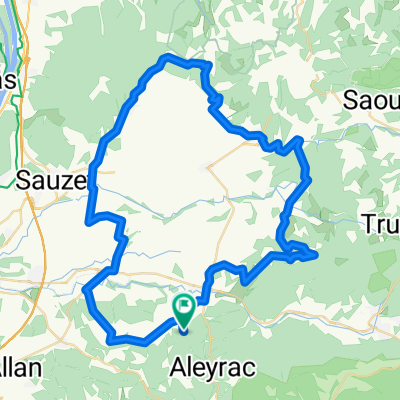
Saint-Gervais-sur-Roubion Comps Dieulefit retour
A cycling route starting in La Bégude-de-Mazenc, Auvergne-Rhône-Alpes, France.
Overview
About this route
50 km sur ds routes de campagne magnifiques. Chapelle de Comps, Dieulefit, Poëte-Laval
- -:--
- Duration
- 49.4 km
- Distance
- 516 m
- Ascent
- 516 m
- Descent
- ---
- Avg. speed
- ---
- Max. altitude

Route quality
Waytypes & surfaces along the route
Waytypes
Road
32.1 km
(65 %)
Busy road
10.5 km
(21 %)
Surfaces
Paved
9 km
(18 %)
Asphalt
9 km
(18 %)
Undefined
40.3 km
(82 %)
Continue with Bikemap
Use, edit, or download this cycling route
You would like to ride Saint-Gervais-sur-Roubion Comps Dieulefit retour or customize it for your own trip? Here is what you can do with this Bikemap route:
Free features
- Save this route as favorite or in collections
- Copy & plan your own version of this route
- Sync your route with Garmin or Wahoo
Premium features
Free trial for 3 days, or one-time payment. More about Bikemap Premium.
- Navigate this route on iOS & Android
- Export a GPX / KML file of this route
- Create your custom printout (try it for free)
- Download this route for offline navigation
Discover more Premium features.
Get Bikemap PremiumFrom our community
Other popular routes starting in La Bégude-de-Mazenc
 Saint-Gervais-sur-Roubion Comps Dieulefit retour
- Distance
- 49.4 km
- Ascent
- 516 m
- Descent
- 516 m
- Location
- La Bégude-de-Mazenc, Auvergne-Rhône-Alpes, France
 kleine Runde Le Poet
- Distance
- 87.7 km
- Ascent
- 1,160 m
- Descent
- 1,160 m
- Location
- La Bégude-de-Mazenc, Auvergne-Rhône-Alpes, France
 Salettes wandeling
- Distance
- 3.5 km
- Ascent
- 61 m
- Descent
- 60 m
- Location
- La Bégude-de-Mazenc, Auvergne-Rhône-Alpes, France
 Drome provencale 1
- Distance
- 60.1 km
- Ascent
- 594 m
- Descent
- 594 m
- Location
- La Bégude-de-Mazenc, Auvergne-Rhône-Alpes, France
 Portes Marsanne Roynac Portes
- Distance
- 71.5 km
- Ascent
- 804 m
- Descent
- 794 m
- Location
- La Bégude-de-Mazenc, Auvergne-Rhône-Alpes, France
 Pas de Lauzun Col de la Chaudiere 1360 hm
- Distance
- 94.4 km
- Ascent
- 1,639 m
- Descent
- 1,629 m
- Location
- La Bégude-de-Mazenc, Auvergne-Rhône-Alpes, France
 Portes Allan Portes
- Distance
- 37.1 km
- Ascent
- 248 m
- Descent
- 285 m
- Location
- La Bégude-de-Mazenc, Auvergne-Rhône-Alpes, France
 Saint-Gervais-sur-Roubion - Aouste
- Distance
- 33.1 km
- Ascent
- 401 m
- Descent
- 317 m
- Location
- La Bégude-de-Mazenc, Auvergne-Rhône-Alpes, France
Open it in the app