

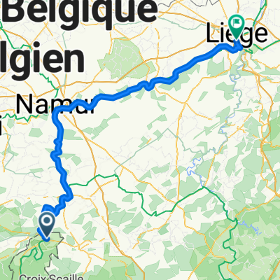
BE. Wallonie Triple des Ardennes 2e etappe
A cycling route starting in Givet, Grand Est, France.
Overview
About this route
Val de Meuse Semois Givet
- -:--
- Duration
- 130.1 km
- Distance
- 1,509 m
- Ascent
- 1,506 m
- Descent
- ---
- Avg. speed
- ---
- Max. altitude

Route quality
Waytypes & surfaces along the route
Waytypes
Busy road
64.7 km
(50 %)
Quiet road
35.5 km
(27 %)
Surfaces
Paved
64.9 km
(50 %)
Unpaved
1.8 km
(1 %)
Asphalt
64.5 km
(50 %)
Ground
1 km
(<1 %)
Continue with Bikemap
Use, edit, or download this cycling route
You would like to ride BE. Wallonie Triple des Ardennes 2e etappe or customize it for your own trip? Here is what you can do with this Bikemap route:
Free features
- Save this route as favorite or in collections
- Copy & plan your own version of this route
- Split it into stages to create a multi-day tour
- Sync your route with Garmin or Wahoo
Premium features
Free trial for 3 days, or one-time payment. More about Bikemap Premium.
- Navigate this route on iOS & Android
- Export a GPX / KML file of this route
- Create your custom printout (try it for free)
- Download this route for offline navigation
Discover more Premium features.
Get Bikemap PremiumFrom our community
Other popular routes starting in Givet
 Maasradtour-3 Givet
- Distance
- 122 km
- Ascent
- 271 m
- Descent
- 311 m
- Location
- Givet, Grand Est, France
 Givet nach Namur
- Distance
- 55.5 km
- Ascent
- 93 m
- Descent
- 120 m
- Location
- Givet, Grand Est, France
 BE. Wallonie Triple des Ardennes 2e etappe
- Distance
- 130.1 km
- Ascent
- 1,509 m
- Descent
- 1,506 m
- Location
- Givet, Grand Est, France
 GIVET-DINANT
- Distance
- 26.3 km
- Ascent
- 260 m
- Descent
- 270 m
- Location
- Givet, Grand Est, France
 Givet - Perpignan via Chevillard et la Chalmette
- Distance
- 1,263.7 km
- Ascent
- 1,986 m
- Descent
- 2,050 m
- Location
- Givet, Grand Est, France
 Route Tacx Namur Revin Part 3 Givet-Revin
- Distance
- 33.8 km
- Ascent
- 479 m
- Descent
- 443 m
- Location
- Givet, Grand Est, France
 Rondje Meuse-Aisne-Oise-Ligne156
- Distance
- 465.4 km
- Ascent
- 2,510 m
- Descent
- 2,511 m
- Location
- Givet, Grand Est, France
 Etappe 5.2: Givet - Rochefort
- Distance
- 33 km
- Ascent
- 174 m
- Descent
- 101 m
- Location
- Givet, Grand Est, France
Open it in the app