

Nagoldtal-Neckartal
A cycling route starting in Unterjettingen, Baden-Wurttemberg, Germany.
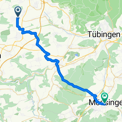
Overview
About this route
Super Tour mit Abwechslung
(cloned from route 1302510)- -:--
- Duration
- 73 km
- Distance
- 575 m
- Ascent
- 577 m
- Descent
- ---
- Avg. speed
- ---
- Max. altitude
Route quality
Waytypes & surfaces along the route
Waytypes
Track
34.8 km
(48 %)
Quiet road
13 km
(18 %)
Surfaces
Paved
53 km
(73 %)
Unpaved
8.9 km
(12 %)
Asphalt
52 km
(71 %)
Gravel
5.4 km
(7 %)
Continue with Bikemap
Use, edit, or download this cycling route
You would like to ride Nagoldtal-Neckartal or customize it for your own trip? Here is what you can do with this Bikemap route:
Free features
- Save this route as favorite or in collections
- Copy & plan your own version of this route
- Sync your route with Garmin or Wahoo
Premium features
Free trial for 3 days, or one-time payment. More about Bikemap Premium.
- Navigate this route on iOS & Android
- Export a GPX / KML file of this route
- Create your custom printout (try it for free)
- Download this route for offline navigation
Discover more Premium features.
Get Bikemap PremiumFrom our community
Other popular routes starting in Unterjettingen
 D-Route 11
- Distance
- 994.7 km
- Ascent
- 7,442 m
- Descent
- 7,910 m
- Location
- Unterjettingen, Baden-Wurttemberg, Germany
 von Gäufelden-Öschelbronn nach Mötzingen
- Distance
- 4.9 km
- Ascent
- 60 m
- Descent
- 26 m
- Location
- Unterjettingen, Baden-Wurttemberg, Germany
 Schönbuch-Rundfahrt_Juli-2011
- Distance
- 56.1 km
- Ascent
- 597 m
- Descent
- 586 m
- Location
- Unterjettingen, Baden-Wurttemberg, Germany
 Gäufelden-Binsdorf
- Distance
- 61.2 km
- Ascent
- 631 m
- Descent
- 519 m
- Location
- Unterjettingen, Baden-Wurttemberg, Germany
 Jettingen - Rottenburg - Tübingen - Jettingen
- Distance
- 64.2 km
- Ascent
- 324 m
- Descent
- 322 m
- Location
- Unterjettingen, Baden-Wurttemberg, Germany
 Kleine Gäurunde
- Distance
- 20.8 km
- Ascent
- 187 m
- Descent
- 186 m
- Location
- Unterjettingen, Baden-Wurttemberg, Germany
 Weg zur Arbeit
- Distance
- 30.1 km
- Ascent
- 308 m
- Descent
- 318 m
- Location
- Unterjettingen, Baden-Wurttemberg, Germany
 LILA LOGISTIK Charity Bike Cup - Gäufelden Öschelbronn
- Distance
- 12.9 km
- Ascent
- 144 m
- Descent
- 144 m
- Location
- Unterjettingen, Baden-Wurttemberg, Germany
Open it in the app