

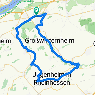
32_Ingelheim – Jugenheim – Schwabenheim – Ingelheim
A cycling route starting in Ingelheim am Rhein, Rhineland-Palatinate, Germany.
Overview
About this route
Auf der Obstroute unterwegs Charakter: Radwege, Weinbergwege, ruhige Landstraßen, ehemalige Bahntrasse
- -:--
- Duration
- 35.6 km
- Distance
- 262 m
- Ascent
- 262 m
- Descent
- ---
- Avg. speed
- ---
- Avg. speed
Route quality
Waytypes & surfaces along the route
Waytypes
Track
11.1 km
(31 %)
Quiet road
10.6 km
(30 %)
Surfaces
Paved
31.5 km
(89 %)
Unpaved
0.1 km
(<1 %)
Asphalt
24.2 km
(68 %)
Paving stones
2.5 km
(7 %)
Route highlights
Points of interest along the route

Point of interest after 12.5 km
Wasserhäuschen: Auf der Höhe zwischen Nieder-Hilbersheim und Engelstadt gibt es ein Wasserhäuschen, in der Art wie sie lange Zeit in Rheinhessen als Speicher zur Wasserversorgung der Gemeinden gebraucht wurden. Sie sind am Anfang des 20. Jhs. im Jugendstil mit schön behauenen Steinen aus der Region

Point of interest after 26 km
Schwabenheim: Der Marktplatz im Dorfmittelpunkt mit Rathaus, Brunnen und Kirche ist umgeben von mehreren Gasthäusern und Winzerhöfen. Im unteren Ortsteil Pfaffenhofen sieht man noch das Hauptgebäude der ehemaligen Benediktiner-Propstei. Bild-/Textquelle: KOMPASS Verlag
Continue with Bikemap
Use, edit, or download this cycling route
You would like to ride 32_Ingelheim – Jugenheim – Schwabenheim – Ingelheim or customize it for your own trip? Here is what you can do with this Bikemap route:
Free features
- Save this route as favorite or in collections
- Copy & plan your own version of this route
- Sync your route with Garmin or Wahoo
Premium features
Free trial for 3 days, or one-time payment. More about Bikemap Premium.
- Navigate this route on iOS & Android
- Export a GPX / KML file of this route
- Create your custom printout (try it for free)
- Download this route for offline navigation
Discover more Premium features.
Get Bikemap PremiumFrom our community
Other popular routes starting in Ingelheim am Rhein
 Ingelheim - Guldental - Wallhausen - Mandel - Waldböckelheim - Odernheim - Bad Münster - Fürfeld - Sprendlingen - Ingelheim
- Distance
- 118.1 km
- Ascent
- 878 m
- Descent
- 876 m
- Location
- Ingelheim am Rhein, Rhineland-Palatinate, Germany
 große Hunsrücktour II Ingelheim, Gemünden, Ingelheim (Variante)
- Distance
- 119.7 km
- Ascent
- 1,586 m
- Descent
- 1,533 m
- Location
- Ingelheim am Rhein, Rhineland-Palatinate, Germany
 "Der Klassiker!"
- Distance
- 46.9 km
- Ascent
- 343 m
- Descent
- 317 m
- Location
- Ingelheim am Rhein, Rhineland-Palatinate, Germany
 010c Ingelheim - Köngernheim - Undenheim - Ingelheim
- Distance
- 61 km
- Ascent
- 386 m
- Descent
- 325 m
- Location
- Ingelheim am Rhein, Rhineland-Palatinate, Germany
 32_Ingelheim – Jugenheim – Schwabenheim – Ingelheim
- Distance
- 35.6 km
- Ascent
- 262 m
- Descent
- 262 m
- Location
- Ingelheim am Rhein, Rhineland-Palatinate, Germany
 Zur Rausch 5
- Distance
- 18 km
- Ascent
- 241 m
- Descent
- 176 m
- Location
- Ingelheim am Rhein, Rhineland-Palatinate, Germany
 "Üwwer die Schiersteiner Brück!"
- Distance
- 39.5 km
- Ascent
- 55 m
- Descent
- 55 m
- Location
- Ingelheim am Rhein, Rhineland-Palatinate, Germany
 Kreuz ud Quer durch schöne Rhoihesse !
- Distance
- 152.1 km
- Ascent
- 1,064 m
- Descent
- 1,064 m
- Location
- Ingelheim am Rhein, Rhineland-Palatinate, Germany
Open it in the app