

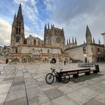
En las Tierras del Cid
A cycling route starting in Burgos, Castille and León, Spain.
Overview
About this route
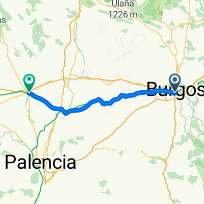
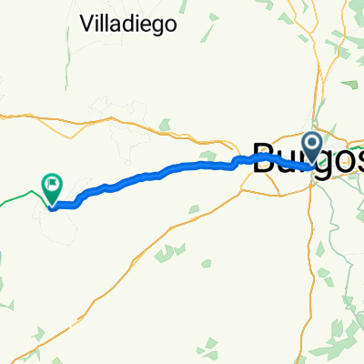
We leave along the bike lane of the Vena River until the end. In Villímar we take the Via Romano path to the golf course. Exiting onto the Poza road, there is a path with an avenue of poplars in front – so that way! From there we go to Celada de la Torre for the vermouth... and to Vivar del Cid for lunch. At the bar they make sandwiches for those who don't know how to prepare them. You have to cross the national road, go under the highway and turn left to Sotragero. From there to Quintanadueñas and along the bike lane that starts from the upper part of the industrial park to Burgos.
- -:--
- Duration
- 43.3 km
- Distance
- 164 m
- Ascent
- 171 m
- Descent
- ---
- Avg. speed
- ---
- Max. altitude

Route quality
Waytypes & surfaces along the route
Waytypes
Track
14.3 km
(33 %)
Road
11.7 km
(27 %)
Surfaces
Paved
20.4 km
(47 %)
Unpaved
13.4 km
(31 %)
Asphalt
19.1 km
(44 %)
Gravel
12.6 km
(29 %)
Continue with Bikemap
Use, edit, or download this cycling route
You would like to ride En las Tierras del Cid or customize it for your own trip? Here is what you can do with this Bikemap route:
Free features
- Save this route as favorite or in collections
- Copy & plan your own version of this route
- Sync your route with Garmin or Wahoo
Premium features
Free trial for 3 days, or one-time payment. More about Bikemap Premium.
- Navigate this route on iOS & Android
- Export a GPX / KML file of this route
- Create your custom printout (try it for free)
- Download this route for offline navigation
Discover more Premium features.
Get Bikemap PremiumFrom our community
Other popular routes starting in Burgos
 Inmunización 2.1 - Viajando al Paleolítico.
- Distance
- 52.8 km
- Ascent
- 515 m
- Descent
- 516 m
- Location
- Burgos, Castille and León, Spain
 2025. 1 nap El Camino
- Distance
- 86.3 km
- Ascent
- 535 m
- Descent
- 565 m
- Location
- Burgos, Castille and León, Spain
 Anormalidad 2.0.1 - Sanctuary regresando por carretera.
- Distance
- 43.6 km
- Ascent
- 323 m
- Descent
- 321 m
- Location
- Burgos, Castille and León, Spain
 BCB. Ruta Día de las Vías Verdes 2017. Versión fácil
- Distance
- 47.4 km
- Ascent
- 198 m
- Descent
- 197 m
- Location
- Burgos, Castille and León, Spain
 Santo Domingo de la Calzada - Espinosa del Camino
- Distance
- 0 km
- Ascent
- 0 m
- Descent
- 0 m
- Location
- Burgos, Castille and León, Spain
 Camino frances"Burgos - SANTIAGO DE COMPOSTELA"
- Distance
- 658.3 km
- Ascent
- 2,735 m
- Descent
- 3,543 m
- Location
- Burgos, Castille and León, Spain
 Calle de San Pablo, Burgos to Burgos
- Distance
- 11.4 km
- Ascent
- 39 m
- Descent
- 42 m
- Location
- Burgos, Castille and León, Spain
 Anormalidad 2.0 - Sanctuary
- Distance
- 37.8 km
- Ascent
- 433 m
- Descent
- 416 m
- Location
- Burgos, Castille and León, Spain
Open it in the app