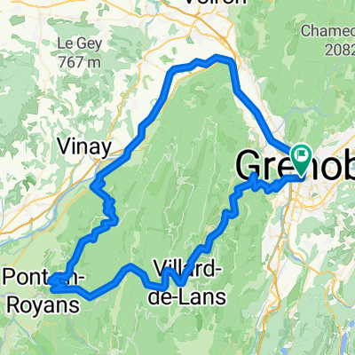
azsazaz
A cycling route starting in Grenoble, Auvergne-Rh么ne-Alpes, France.
Overview
About this route
ezzeaazeaze
(cloned from route 2183332)- -:--
- Duration
- 53.7 km
- Distance
- 593 m
- Ascent
- 595 m
- Descent
- ---
- Avg. speed
- ---
- Max. altitude
Route quality
Waytypes & surfaces along the route
Waytypes
Busy road
28.1 km
(52 %)
Road
10.3 km
(19 %)
Surfaces
Paved
40.5 km
(76 %)
Unpaved
0.1 km
(<1 %)
Asphalt
38.1 km
(71 %)
Concrete
1.6 km
(3 %)
Continue with Bikemap
Use, edit, or download this cycling route
You would like to ride azsazaz or customize it for your own trip? Here is what you can do with this Bikemap route:
Free features
- Save this route as favorite or in collections
- Copy & plan your own version of this route
- Sync your route with Garmin or Wahoo
Premium features
Free trial for 3 days, or one-time payment. More about Bikemap Premium.
- Navigate this route on iOS & Android
- Export a GPX / KML file of this route
- Create your custom printout (try it for free)
- Download this route for offline navigation
Discover more Premium features.
Get Bikemap PremiumFrom our community
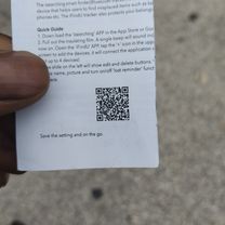
Other popular routes starting in Grenoble
- Grenoble Saint Nizier retour Sassenage
- Distance
- 58.3 km
- Ascent
- 972 m
- Descent
- 972 m
- Location
- Grenoble, Auvergne-Rh么ne-Alpes, France
- Chateau de Vizille
- Distance
- 33.1 km
- Ascent
- 300 m
- Descent
- 301 m
- Location
- Grenoble, Auvergne-Rh么ne-Alpes, France
- Col du Palaquit
- Distance
- 16.4 km
- Ascent
- 936 m
- Descent
- 13 m
- Location
- Grenoble, Auvergne-Rh么ne-Alpes, France
- France - Grenoble - Col de la Placette
- Distance
- 61.5 km
- Ascent
- 502 m
- Descent
- 505 m
- Location
- Grenoble, Auvergne-Rh么ne-Alpes, France
- Chamrousse
- Distance
- 64.8 km
- Ascent
- 1,555 m
- Descent
- 1,555 m
- Location
- Grenoble, Auvergne-Rh么ne-Alpes, France
- Chartreuse - Col de Porte et col du Coq
- Distance
- 70.2 km
- Ascent
- 1,813 m
- Descent
- 1,814 m
- Location
- Grenoble, Auvergne-Rh么ne-Alpes, France
- Day 3 - Grenoble to Saint-Pierre-d'Argen莽on
- Distance
- 99.6 km
- Ascent
- 1,451 m
- Descent
- 883 m
- Location
- Grenoble, Auvergne-Rh么ne-Alpes, France
- ballade test 脿 renage avec bosse
- Distance
- 46.4 km
- Ascent
- 429 m
- Descent
- 446 m
- Location
- Grenoble, Auvergne-Rh么ne-Alpes, France
Open it in the app