

po Parku Narodowym "Bory Tucholskie"
A cycling route starting in Chojnice, Pomeranian Voivodeship, Poland.
Overview
About this route
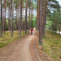
Flat route. Many sandy sections along the way. Beautiful views on the road and absolute silence.
- -:--
- Duration
- 31.9 km
- Distance
- 155 m
- Ascent
- 155 m
- Descent
- ---
- Avg. speed
- ---
- Max. altitude

Continue with Bikemap
Use, edit, or download this cycling route
You would like to ride po Parku Narodowym "Bory Tucholskie" or customize it for your own trip? Here is what you can do with this Bikemap route:
Free features
- Save this route as favorite or in collections
- Copy & plan your own version of this route
- Sync your route with Garmin or Wahoo
Premium features
Free trial for 3 days, or one-time payment. More about Bikemap Premium.
- Navigate this route on iOS & Android
- Export a GPX / KML file of this route
- Create your custom printout (try it for free)
- Download this route for offline navigation
Discover more Premium features.
Get Bikemap PremiumFrom our community
Other popular routes starting in Chojnice
 Wyprawa nr 2
- Distance
- 49.9 km
- Ascent
- 163 m
- Descent
- 164 m
- Location
- Chojnice, Pomeranian Voivodeship, Poland
 Chojnice, Chojnice do Łąkowa, Charzykowy
- Distance
- 43.4 km
- Ascent
- 706 m
- Descent
- 749 m
- Location
- Chojnice, Pomeranian Voivodeship, Poland
 Dąb Bartek
- Distance
- 34.5 km
- Ascent
- 155 m
- Descent
- 158 m
- Location
- Chojnice, Pomeranian Voivodeship, Poland
 Czarnoszyce
- Distance
- 14.5 km
- Ascent
- 118 m
- Descent
- 148 m
- Location
- Chojnice, Pomeranian Voivodeship, Poland
 Ósemka Charzykowska
- Distance
- 49.6 km
- Ascent
- 251 m
- Descent
- 251 m
- Location
- Chojnice, Pomeranian Voivodeship, Poland
 Charzykowy Tour
- Distance
- 38 km
- Ascent
- 180 m
- Descent
- 182 m
- Location
- Chojnice, Pomeranian Voivodeship, Poland
 po Parku Narodowym "Bory Tucholskie"
- Distance
- 31.9 km
- Ascent
- 155 m
- Descent
- 155 m
- Location
- Chojnice, Pomeranian Voivodeship, Poland
 Chociński Młyn Bachorze Ch.M.
- Distance
- 13.4 km
- Ascent
- 107 m
- Descent
- 141 m
- Location
- Chojnice, Pomeranian Voivodeship, Poland
Open it in the app