

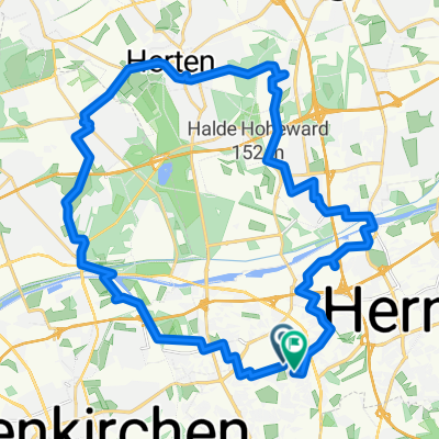
Herne - Herten und Umgebung
A cycling route starting in Bochum-Hordel, North Rhine-Westphalia, Germany.
Overview
About this route
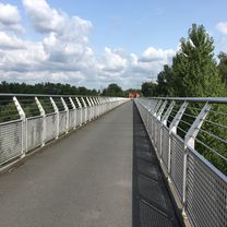
Through Eickel, Bickern, Unser Fritz along the canal next to the new Zoom Zoo and over the new bridge up to about the height of the Klaeser gas station along the canal. Then to Herten to the Ewald mine where one can take a little break for coffee and cake, then it continues through Herten City to the Schlosspark Herten. Then through the forests back. At the height of Lidl in Herten, turn right around the Ewald mine, thus returning by another path. Very fast and varied route.
- -:--
- Duration
- 29.9 km
- Distance
- 91 m
- Ascent
- 91 m
- Descent
- ---
- Avg. speed
- ---
- Max. altitude

Continue with Bikemap
Use, edit, or download this cycling route
You would like to ride Herne - Herten und Umgebung or customize it for your own trip? Here is what you can do with this Bikemap route:
Free features
- Save this route as favorite or in collections
- Copy & plan your own version of this route
- Sync your route with Garmin or Wahoo
Premium features
Free trial for 3 days, or one-time payment. More about Bikemap Premium.
- Navigate this route on iOS & Android
- Export a GPX / KML file of this route
- Create your custom printout (try it for free)
- Download this route for offline navigation
Discover more Premium features.
Get Bikemap PremiumFrom our community
Other popular routes starting in Bochum-Hordel
 Route nach Herne
- Distance
- 32.2 km
- Ascent
- 110 m
- Descent
- 111 m
- Location
- Bochum-Hordel, North Rhine-Westphalia, Germany
 Sarnsbankstraße nach Sarnsbankstraße
- Distance
- 27.7 km
- Ascent
- 178 m
- Descent
- 176 m
- Location
- Bochum-Hordel, North Rhine-Westphalia, Germany
 Kwälix 02
- Distance
- 31.3 km
- Ascent
- 175 m
- Descent
- 164 m
- Location
- Bochum-Hordel, North Rhine-Westphalia, Germany
 Herner Haldentour (leicht)
- Distance
- 32.1 km
- Ascent
- 75 m
- Descent
- 63 m
- Location
- Bochum-Hordel, North Rhine-Westphalia, Germany
 Rundkurs brennerstr Ruhr nach Essen CLONED FROM ROUTE 385381
- Distance
- 37.3 km
- Ascent
- 206 m
- Descent
- 203 m
- Location
- Bochum-Hordel, North Rhine-Westphalia, Germany
 ipa 2024 Herbstrunde
- Distance
- 45.6 km
- Ascent
- 153 m
- Descent
- 167 m
- Location
- Bochum-Hordel, North Rhine-Westphalia, Germany
 Erzbahntrasse
- Distance
- 38.7 km
- Ascent
- 212 m
- Descent
- 152 m
- Location
- Bochum-Hordel, North Rhine-Westphalia, Germany
 Niederlande Rundtour
- Distance
- 1,148.1 km
- Ascent
- 174 m
- Descent
- 174 m
- Location
- Bochum-Hordel, North Rhine-Westphalia, Germany
Open it in the app