

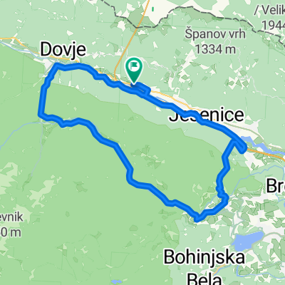
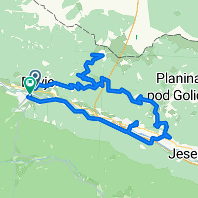
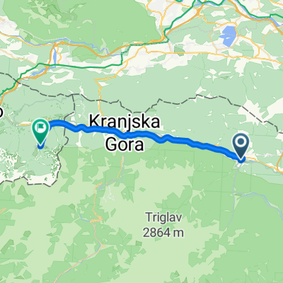
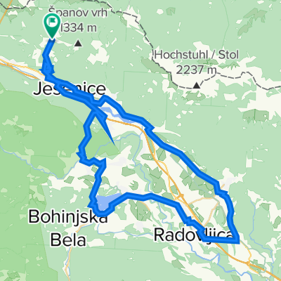
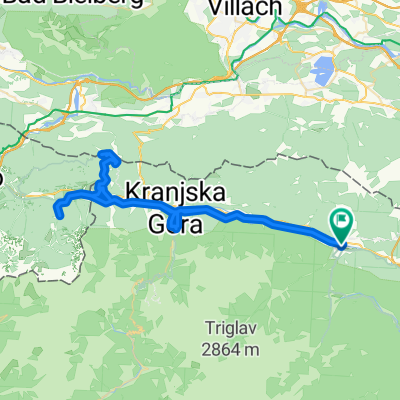
hrustica - vodopad - mojstrana - kranjska gora
A cycling route starting in Hrušica, Jesenice, Slovenia.
Overview
About this route
hrustica - waterfall - Mojstrana - Kranjska Gora
- -:--
- Duration
- 40.2 km
- Distance
- 597 m
- Ascent
- 375 m
- Descent
- ---
- Avg. speed
- ---
- Max. altitude

Continue with Bikemap
Use, edit, or download this cycling route
You would like to ride hrustica - vodopad - mojstrana - kranjska gora or customize it for your own trip? Here is what you can do with this Bikemap route:
Free features
- Save this route as favorite or in collections
- Copy & plan your own version of this route
- Sync your route with Garmin or Wahoo
Premium features
Free trial for 3 days, or one-time payment. More about Bikemap Premium.
- Navigate this route on iOS & Android
- Export a GPX / KML file of this route
- Create your custom printout (try it for free)
- Download this route for offline navigation
Discover more Premium features.
Get Bikemap PremiumFrom our community
Other popular routes starting in Hrušica
 Route in Hrušica
- Distance
- 42.5 km
- Ascent
- 992 m
- Descent
- 990 m
- Location
- Hrušica, Jesenice, Slovenia
 Mojstrana Dovje to Triglavska cesta
- Distance
- 36.2 km
- Ascent
- 1,950 m
- Descent
- 1,971 m
- Location
- Hrušica, Jesenice, Slovenia
 Triglavska cesta to LAGO SUPERIORE DI FUSINE via dei Laghi
- Distance
- 25.1 km
- Ascent
- 487 m
- Descent
- 200 m
- Location
- Hrušica, Jesenice, Slovenia
 Slow ride in Kranjska Gora
- Distance
- 17.4 km
- Ascent
- 429 m
- Descent
- 259 m
- Location
- Hrušica, Jesenice, Slovenia
 Bledi tókerülés (hard core)
- Distance
- 56 km
- Ascent
- 979 m
- Descent
- 978 m
- Location
- Hrušica, Jesenice, Slovenia
 Mojstrana-Valbruna
- Distance
- 40.6 km
- Ascent
- 433 m
- Descent
- 260 m
- Location
- Hrušica, Jesenice, Slovenia
 VRŠIČ
VRŠIČ- Distance
- 52.9 km
- Ascent
- 1,185 m
- Descent
- 1,232 m
- Location
- Hrušica, Jesenice, Slovenia
 Route in Mojstrana
- Distance
- 65 km
- Ascent
- 1,567 m
- Descent
- 1,568 m
- Location
- Hrušica, Jesenice, Slovenia
Open it in the app