

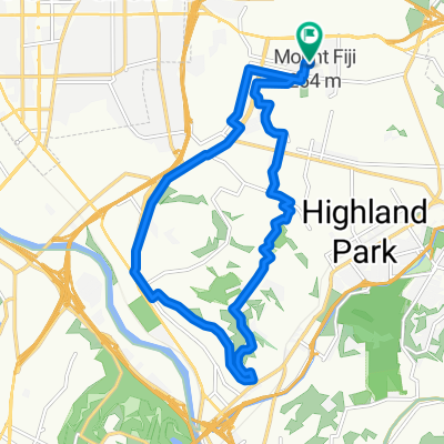
rose bowl via ave. 66
A cycling route starting in Glendale, California, United States of America.
Overview
About this route
From home to rose bowl via ave. 66 and across Lida to Chevy Chase canyon and back home.
- -:--
- Duration
- 34.8 km
- Distance
- 413 m
- Ascent
- 409 m
- Descent
- ---
- Avg. speed
- ---
- Max. altitude
Route quality
Waytypes & surfaces along the route
Waytypes
Quiet road
12.7 km
(37 %)
Busy road
10.2 km
(29 %)
Surfaces
Paved
11.1 km
(32 %)
Asphalt
11.1 km
(32 %)
Undefined
23.7 km
(68 %)
Continue with Bikemap
Use, edit, or download this cycling route
You would like to ride rose bowl via ave. 66 or customize it for your own trip? Here is what you can do with this Bikemap route:
Free features
- Save this route as favorite or in collections
- Copy & plan your own version of this route
- Sync your route with Garmin or Wahoo
Premium features
Free trial for 3 days, or one-time payment. More about Bikemap Premium.
- Navigate this route on iOS & Android
- Export a GPX / KML file of this route
- Create your custom printout (try it for free)
- Download this route for offline navigation
Discover more Premium features.
Get Bikemap PremiumFrom our community
Other popular routes starting in Glendale
 eagle rock Pasadena hilly ride
- Distance
- 27.9 km
- Ascent
- 734 m
- Descent
- 723 m
- Location
- Glendale, California, United States of America
 La Tuna Loop
- Distance
- 51.9 km
- Ascent
- 611 m
- Descent
- 495 m
- Location
- Glendale, California, United States of America
 Mt. Wilson Climb
- Distance
- 80.3 km
- Ascent
- 4,213 m
- Descent
- 3,765 m
- Location
- Glendale, California, United States of America
 Mullholland Drive via Sunset CLONED FROM ROUTE 329585
- Distance
- 45.1 km
- Ascent
- 421 m
- Descent
- 421 m
- Location
- Glendale, California, United States of America
 Griffith Park Hollywood sign loop
- Distance
- 30.9 km
- Ascent
- 687 m
- Descent
- 678 m
- Location
- Glendale, California, United States of America
 Steady ride in Los Angelesm
- Distance
- 14.2 km
- Ascent
- 183 m
- Descent
- 175 m
- Location
- Glendale, California, United States of America
 Eagle rock - rose bowl - Glendale
- Distance
- 21 km
- Ascent
- 593 m
- Descent
- 578 m
- Location
- Glendale, California, United States of America
 Mt. Washington Loop (Clockwise)
- Distance
- 16.5 km
- Ascent
- 197 m
- Descent
- 200 m
- Location
- Glendale, California, United States of America
Open it in the app