4 den 2/2
- 43.8 km
- 681 m
- 804 m
- Orašac, Federation of Bosnia and Herzegovina, Bosnia and Herzegovina
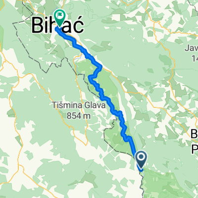
Štrbački buk
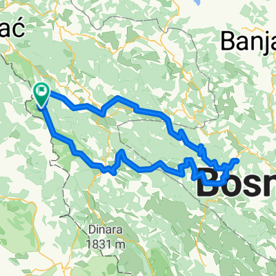
A cycling route starting in Orašac, Federation of Bosnia and Herzegovina, Bosnia and Herzegovina.
Overview
From Donji Lapac to the waterfalls of Strbacki Buk. Route is in CROATIA.
created this 10 years ago
Part of
Štrbački buk
1 stage
Route quality
Road
15.9 km
(31 %)
Track
5.7 km
(11 %)
Paved
25.7 km
(50 %)
Unpaved
1 km
(2 %)
Asphalt
25.7 km
(50 %)
Unpaved (undefined)
1 km
(2 %)
Undefined
24.7 km
(48 %)
Route highlights

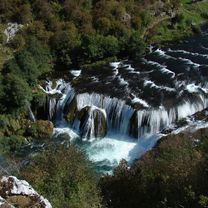
The waterfall of Strbacki Buk.

Vidikovac na koji se penje sa puta na kojem se sa desne strane nalazi velika tabla sa oznakom. Pored table počinju stepenice koje vode na stazu kojom se za 8-10 minuta stiže na najljepše mijesto iznad Une sa kojega se pruža jedinstven pogled na veliki slap i rijeku.
Continue with Bikemap
You would like to ride Donji Lapac - Strbacki Buk - Mišljenovac - Donji Lapac or customize it for your own trip? Here is what you can do with this Bikemap route:
Free trial for 3 days, or one-time payment. More about Bikemap Premium.
Discover more Premium features.
Get Bikemap PremiumFrom our community
Open it in the app