Rampušák krátká 2013
- 100.2 km
- 1,314 m
- 1,226 m
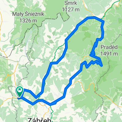
- Štíty, Olomoucký kraj, Czechia
A cycling route starting in Štíty, Olomoucký kraj, Czechia.
Overview
Route of the Rampušák 2016 race
created this 11 years ago
Route quality
Road
31.1 km
26 %
Quiet road
6 km
5 %
Paved
90.9 km
(76 %)
Asphalt
90.9 km
76 %
Undefined
28.7 km
24 %
Route highlights
Občerstvovací stanice I a II
Continue with Bikemap
You would like to ride Rampušák 2016 - 120 km or customize it for your own trip? Here is what you can do with this Bikemap route:
Free trial for 3 days, or one-time payment. More about Bikemap Premium.
Discover more Premium features.
Get Bikemap PremiumFrom our community
Open it in the app