

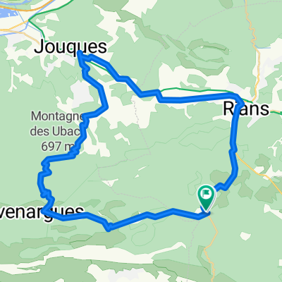
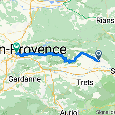
Lost Water Bottle Ride
A cycling route starting in Pourrières, Provence-Alpes-Côte d'Azur Region, France.
Overview
About this route
Quick Loop while the girls were in school. From Purriers, through Puisloubier, up onto the plateau.
- -:--
- Duration
- 26.8 km
- Distance
- 373 m
- Ascent
- 378 m
- Descent
- ---
- Avg. speed
- ---
- Max. altitude

Route quality
Waytypes & surfaces along the route
Waytypes
Road
26.6 km
(99 %)
Quiet road
0.3 km
(1 %)
Surfaces
Paved
17.4 km
(65 %)
Asphalt
17.4 km
(65 %)
Undefined
9.4 km
(35 %)
Continue with Bikemap
Use, edit, or download this cycling route
You would like to ride Lost Water Bottle Ride or customize it for your own trip? Here is what you can do with this Bikemap route:
Free features
- Save this route as favorite or in collections
- Copy & plan your own version of this route
- Sync your route with Garmin or Wahoo
Premium features
Free trial for 3 days, or one-time payment. More about Bikemap Premium.
- Navigate this route on iOS & Android
- Export a GPX / KML file of this route
- Create your custom printout (try it for free)
- Download this route for offline navigation
Discover more Premium features.
Get Bikemap PremiumFrom our community
Other popular routes starting in Pourrières
 Face Nord de la sainte-Victoire
- Distance
- 43.6 km
- Ascent
- 590 m
- Descent
- 594 m
- Location
- Pourrières, Provence-Alpes-Côte d'Azur Region, France
 37- contrastes à pourrieres
- Distance
- 22.2 km
- Ascent
- 347 m
- Descent
- 347 m
- Location
- Pourrières, Provence-Alpes-Côte d'Azur Region, France
 D 623, Pourrières à 365E Chemin de Belle Vue, Pourrières
- Distance
- 29.3 km
- Ascent
- 436 m
- Descent
- 405 m
- Location
- Pourrières, Provence-Alpes-Côte d'Azur Region, France
 Charlytest
- Distance
- 31.4 km
- Ascent
- 407 m
- Descent
- 525 m
- Location
- Pourrières, Provence-Alpes-Côte d'Azur Region, France
 Monext : Ironman Pays d'Aix Part 2
- Distance
- 31.2 km
- Ascent
- 424 m
- Descent
- 543 m
- Location
- Pourrières, Provence-Alpes-Côte d'Azur Region, France
 Lost Water Bottle Ride
- Distance
- 26.8 km
- Ascent
- 373 m
- Descent
- 378 m
- Location
- Pourrières, Provence-Alpes-Côte d'Azur Region, France
 Pourrieres-rians-varages-st maximin-trets-Pourrières
- Distance
- 77 km
- Ascent
- 605 m
- Descent
- 605 m
- Location
- Pourrières, Provence-Alpes-Côte d'Azur Region, France
 Mont Sainte Victoire
- Distance
- 63.6 km
- Ascent
- 879 m
- Descent
- 878 m
- Location
- Pourrières, Provence-Alpes-Côte d'Azur Region, France
Open it in the app