

Löwensteiner Berge (Steinknickle-Limes-Tobelschlucht-Silberstollen)
A cycling route starting in Wüstenrot, Baden-Wurttemberg, Germany.
Overview
About this route
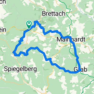
Start Hasenhof on B39 - Steinknickle - Finsterroter Lake - Ammertsweiler - Dennhof - Mainhardt - Limesweg - Grab - Hohe Brach (AT) - Großerlach - Kleinerlach - 'Falsche Tobelschlucht' - Vorderbüchelberg - Neulautern - Wellingtonienplatz - Silberstollen Wüstenrot - Spatzenhof - Hasenhof; partly quite rough tour mostly on marked hiking trails with sections where you need to carry the bike (cloned from route 15375)
- -:--
- Duration
- 38.9 km
- Distance
- 656 m
- Ascent
- 656 m
- Descent
- ---
- Avg. speed
- ---
- Max. altitude

Route highlights
Points of interest along the route
Point of interest after 14.5 km
P Hankertsmühle, ehem. röm. Kastell
Point of interest after 28.3 km
Beginn "Falsche Tobelschlucht"
Point of interest after 31.1 km
PP "Ebene" Vorderbüchelberg
Point of interest after 35.1 km
Wellingtonienplatz Wüstenrot
Point of interest after 36.8 km
Silberstollen Wüstenrot
Continue with Bikemap
Use, edit, or download this cycling route
You would like to ride Löwensteiner Berge (Steinknickle-Limes-Tobelschlucht-Silberstollen) or customize it for your own trip? Here is what you can do with this Bikemap route:
Free features
- Save this route as favorite or in collections
- Copy & plan your own version of this route
- Sync your route with Garmin or Wahoo
Premium features
Free trial for 3 days, or one-time payment. More about Bikemap Premium.
- Navigate this route on iOS & Android
- Export a GPX / KML file of this route
- Create your custom printout (try it for free)
- Download this route for offline navigation
Discover more Premium features.
Get Bikemap PremiumFrom our community
Other popular routes starting in Wüstenrot
 Trainingsrunde 1
- Distance
- 42.1 km
- Ascent
- 367 m
- Descent
- 367 m
- Location
- Wüstenrot, Baden-Wurttemberg, Germany
 Wüstenrot-Mainhardt-Wüstenrot
- Distance
- 28 km
- Ascent
- 243 m
- Descent
- 244 m
- Location
- Wüstenrot, Baden-Wurttemberg, Germany
 Kurzstrecke Rundweg Neuhütten - Mainhardt - Wüstenrot
- Distance
- 23.5 km
- Ascent
- 312 m
- Descent
- 314 m
- Location
- Wüstenrot, Baden-Wurttemberg, Germany
 Finsterrot: Dachsi Naturerlebnispfad
- Distance
- 2.7 km
- Ascent
- 39 m
- Descent
- 43 m
- Location
- Wüstenrot, Baden-Wurttemberg, Germany
 Rundweg von Neuhütten nach Schwäbisch Hall und zurück
- Distance
- 62.8 km
- Ascent
- 706 m
- Descent
- 735 m
- Location
- Wüstenrot, Baden-Wurttemberg, Germany
 Rundweh:Neuh.- Stocksberg-Hirrweiler-Neuh.
- Distance
- 22.2 km
- Ascent
- 472 m
- Descent
- 467 m
- Location
- Wüstenrot, Baden-Wurttemberg, Germany
 Löwensteiner Berge (Steinknickle-Limes-Tobelschlucht-Silberstollen)
- Distance
- 38.9 km
- Ascent
- 656 m
- Descent
- 656 m
- Location
- Wüstenrot, Baden-Wurttemberg, Germany
 Heimstrecke
- Distance
- 16.5 km
- Ascent
- 310 m
- Descent
- 302 m
- Location
- Wüstenrot, Baden-Wurttemberg, Germany
Open it in the app