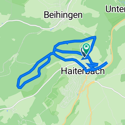
Salzstetten Ausfahrt Heubergradler
A cycling route starting in Haiterbach, Baden-Wurttemberg, Germany.
Overview
About this route
2-day tour Salzstetten Sasbachwalden Offenburg, by train from Offenburg to Freudenstadt then to Dornstetten and then back to Salzstetten by mountain bike
- -:--
- Duration
- 88.7 km
- Distance
- 1,216 m
- Ascent
- 1,651 m
- Descent
- ---
- Avg. speed
- ---
- Max. altitude
Continue with Bikemap
Use, edit, or download this cycling route
You would like to ride Salzstetten Ausfahrt Heubergradler or customize it for your own trip? Here is what you can do with this Bikemap route:
Free features
- Save this route as favorite or in collections
- Copy & plan your own version of this route
- Split it into stages to create a multi-day tour
- Sync your route with Garmin or Wahoo
Premium features
Free trial for 3 days, or one-time payment. More about Bikemap Premium.
- Navigate this route on iOS & Android
- Export a GPX / KML file of this route
- Create your custom printout (try it for free)
- Download this route for offline navigation
Discover more Premium features.
Get Bikemap PremiumFrom our community
Other popular routes starting in Haiterbach
- Im Ölern, Haiterbach nach Im Ölern, Haiterbach
- Distance
- 19 km
- Ascent
- 319 m
- Descent
- 321 m
- Location
- Haiterbach, Baden-Wurttemberg, Germany
- Erzgrube über Haiterbach
- Distance
- 59.2 km
- Ascent
- 992 m
- Descent
- 1,077 m
- Location
- Haiterbach, Baden-Wurttemberg, Germany
- TH-RW-KN
- Distance
- 140.8 km
- Ascent
- 3,435 m
- Descent
- 3,556 m
- Location
- Haiterbach, Baden-Wurttemberg, Germany
- K4779 7, Horb am Neckar nach Regenüberlaufbecken 2.5, Seewald
- Distance
- 21.2 km
- Ascent
- 535 m
- Descent
- 527 m
- Location
- Haiterbach, Baden-Wurttemberg, Germany
- Drei Täler Runde
- Distance
- 73.3 km
- Ascent
- 1,373 m
- Descent
- 1,375 m
- Location
- Haiterbach, Baden-Wurttemberg, Germany
- MyTouer
- Distance
- 23.7 km
- Ascent
- 345 m
- Descent
- 340 m
- Location
- Haiterbach, Baden-Wurttemberg, Germany
- Test
- Distance
- 27.3 km
- Ascent
- 303 m
- Descent
- 303 m
- Location
- Haiterbach, Baden-Wurttemberg, Germany
- Beihingen-Iselshausen-Gündringen-Beihingen
- Distance
- 19.2 km
- Ascent
- 346 m
- Descent
- 346 m
- Location
- Haiterbach, Baden-Wurttemberg, Germany
Open it in the app