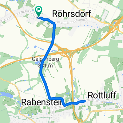
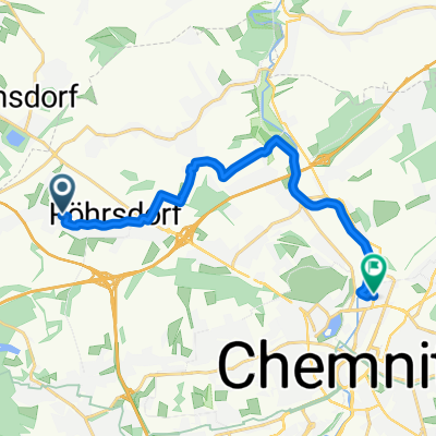
Einradeln zum Tharandter Wald

A cycling route starting in Wittgensdorf, Saxony, Germany.
OverviewAbout this route

Pleasure tour with many climbs, especially Landberg and Berthelsdorfer Berg

Translated, show original (German)
-:--
Duration
139.4 km
Distance
817 m
Ascent
818 m
Descent
---
Avg. speed
---
Max. altitude
seitenstechercreated this 11 years ago
Route qualityWaytypes & surfaces along the route
Waytypes
  • Road

    34.9 km25 %
  • Quiet road

    22.3 km16 %
  • Access road

    5.6 km4 %
Surfaces

Paved

97.6 km(70 %)

Unpaved

4.2 km(3 %)
  • Asphalt

    96.2 km69 %
  • Paved (undefined)

    1.4 km1 %
  • Unpaved (undefined)

    1.4 km1 %
Continue with BikemapUse, edit, or download this cycling route
You would like to ride Einradeln zum Tharandter Wald or customize it for your own trip? Here is what you can do with this Bikemap route:
Free features
Premium features

Free trial for 3 days, or one-time payment. More about Bikemap Premium.

  • Navigate this route on iOS & Android
  • Export a GPX / KML file of this route
  • Create your custom printout (try it for free)
  • Download this route for offline navigation

Discover more Premium features.

Get Bikemap Premium
From our communityOther popular routes starting in Wittgensdorf

Open it in the app