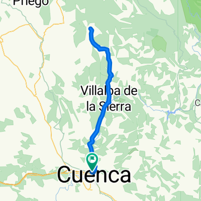
Bajada senda Casasola
A cycling route starting in Cuenca, Castille-La Mancha, Spain.
Overview
About this route
Subida a Casasola por el camino y bajada por la senda.
- -:--
- Duration
- 13.8 km
- Distance
- 209 m
- Ascent
- 209 m
- Descent
- ---
- Avg. speed
- ---
- Avg. speed
Route quality
Waytypes & surfaces along the route
Waytypes
Busy road
5.4 km
(39 %)
Path
3.5 km
(25 %)
Surfaces
Paved
1.9 km
(14 %)
Unpaved
3.1 km
(22 %)
Ground
2.5 km
(18 %)
Asphalt
1.9 km
(14 %)
Route highlights
Points of interest along the route
Point of interest after 3.2 km
Subida por el camino
Point of interest after 6.6 km
Bajada por la senda
Point of interest after 10.1 km
Senda de los ancianitos
Continue with Bikemap
Use, edit, or download this cycling route
You would like to ride Bajada senda Casasola or customize it for your own trip? Here is what you can do with this Bikemap route:
Free features
- Save this route as favorite or in collections
- Copy & plan your own version of this route
- Sync your route with Garmin or Wahoo
Premium features
Free trial for 3 days, or one-time payment. More about Bikemap Premium.
- Navigate this route on iOS & Android
- Export a GPX / KML file of this route
- Create your custom printout (try it for free)
- Download this route for offline navigation
Discover more Premium features.
Get Bikemap PremiumFrom our community
Other popular routes starting in Cuenca
- Las Zomas. La Mota
- Distance
- 42.6 km
- Ascent
- 517 m
- Descent
- 516 m
- Location
- Cuenca, Castille-La Mancha, Spain
- Arroyo Bonilla
- Distance
- 25.9 km
- Ascent
- 604 m
- Descent
- 604 m
- Location
- Cuenca, Castille-La Mancha, Spain
- Alto de la Nava
- Distance
- 46.3 km
- Ascent
- 625 m
- Descent
- 624 m
- Location
- Cuenca, Castille-La Mancha, Spain
- El Terminillo
- Distance
- 12.8 km
- Ascent
- 37 m
- Descent
- 38 m
- Location
- Cuenca, Castille-La Mancha, Spain
- Cuenca-ciudad encantada-
- Distance
- 63.7 km
- Ascent
- 995 m
- Descent
- 989 m
- Location
- Cuenca, Castille-La Mancha, Spain
- Sierra de Valdecabras
- Distance
- 50.5 km
- Ascent
- 1,896 m
- Descent
- 1,896 m
- Location
- Cuenca, Castille-La Mancha, Spain
- Mirador de el Ceño
- Distance
- 43.9 km
- Ascent
- 483 m
- Descent
- 483 m
- Location
- Cuenca, Castille-La Mancha, Spain
- Lagunas de Fuentes
- Distance
- 40.5 km
- Ascent
- 318 m
- Descent
- 318 m
- Location
- Cuenca, Castille-La Mancha, Spain
Open it in the app