

RTF RSV Undenheim Tour 2: 112 km
A cycling route starting in Undenheim, Rhineland-Palatinate, Germany.
Overview
About this route
0 km Undenheim<br />7 km Bechtolsheim<br />8 km Biebelnheim<br />16 km Bornheim<br />18 km Flonheim<br />20 km Kontrolle K1<br />22 km Wendelsheim<br />27 km Wonsheim<br />30 km Hof Iben<br />32 km Tiefenthal<br />34 km Niederhausen<br />36 km Münsterappel<br />38 km Oberhausen<br />39 km Gaugrehweiler<br />42 km St. Alban<br />43 km Gerbach<br />46 km Würzweiler<br />50 km Marienthal<br />52 km Bastenhaus<br />53 km Kontrolle K2<br />61 km Kirchheim-Bolanden<br />65 km Rittersheim<br />73 km Flomborn<br />75 km Gundersheim<br />79 km Kontrolle K3<br />80 km Westhofen<br />87 km Osthofen<br />91 km Mettenheim<br />94 km Alsheim<br />100 km Dorn-Dürkheim<br />101 km Hillesheim<br />104 km Dolgesheim<br />107 km Weinolsheim<br />110 km Friesenheim<br />112 km Undenheim
- -:--
- Duration
- 110.5 km
- Distance
- 908 m
- Ascent
- 930 m
- Descent
- ---
- Avg. speed
- 466 m
- Max. altitude
Route quality
Waytypes & surfaces along the route
Waytypes
Track
26.5 km
(24 %)
Quiet road
7.7 km
(7 %)
Surfaces
Paved
90.6 km
(82 %)
Unpaved
9.9 km
(9 %)
Asphalt
83.9 km
(76 %)
Ground
6.6 km
(6 %)
Continue with Bikemap
Use, edit, or download this cycling route
You would like to ride RTF RSV Undenheim Tour 2: 112 km or customize it for your own trip? Here is what you can do with this Bikemap route:
Free features
- Save this route as favorite or in collections
- Copy & plan your own version of this route
- Split it into stages to create a multi-day tour
- Sync your route with Garmin or Wahoo
Premium features
Free trial for 3 days, or one-time payment. More about Bikemap Premium.
- Navigate this route on iOS & Android
- Export a GPX / KML file of this route
- Create your custom printout (try it for free)
- Download this route for offline navigation
Discover more Premium features.
Get Bikemap PremiumFrom our community
Other popular routes starting in Undenheim
 20170528_080203.gpx
- Distance
- 86.8 km
- Ascent
- 521 m
- Descent
- 521 m
- Location
- Undenheim, Rhineland-Palatinate, Germany
 Rheinhessen-Kleeblatt-Marathon 2013 - Marathon des RSV 1921 Undenheim e.V. - 204 km Strecke
- Distance
- 205.1 km
- Ascent
- 862 m
- Descent
- 862 m
- Location
- Undenheim, Rhineland-Palatinate, Germany
 Rheinhessisches Hügelland
- Distance
- 58 km
- Ascent
- 411 m
- Descent
- 408 m
- Location
- Undenheim, Rhineland-Palatinate, Germany
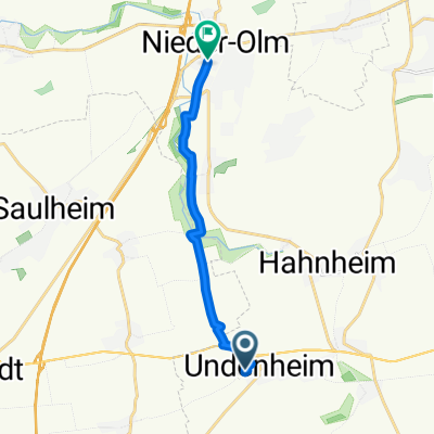 Am Eisweiher, Undenheim nach Pariser Straße, Nieder-Olm
- Distance
- 9.4 km
- Ascent
- 42 m
- Descent
- 61 m
- Location
- Undenheim, Rhineland-Palatinate, Germany
 Staatsrat-Schwamb-Straße 50, Undenheim nach Lehrer-Wagner-Straße 4, Selzen
- Distance
- 4.5 km
- Ascent
- 15 m
- Descent
- 21 m
- Location
- Undenheim, Rhineland-Palatinate, Germany
 Kleeblattmarathon
- Distance
- 199.4 km
- Ascent
- 910 m
- Descent
- 910 m
- Location
- Undenheim, Rhineland-Palatinate, Germany
 K36 47, Undenheim nach Am Schinnergraben 16, Mainz
- Distance
- 18.3 km
- Ascent
- 38 m
- Descent
- 4 m
- Location
- Undenheim, Rhineland-Palatinate, Germany
 Durch die Rheinhessische Schweiz 2016 - 80 km Permanente des RSV 1921 Undenheim e.V.
- Distance
- 78.7 km
- Ascent
- 592 m
- Descent
- 592 m
- Location
- Undenheim, Rhineland-Palatinate, Germany
Open it in the app