

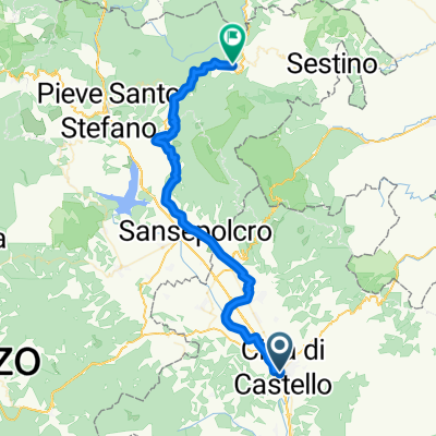
Italy Day 9, 48/730, Citta di Castello - Badia Tedalda
A cycling route starting in Città di Castello, Umbria, Italy.
Overview
About this route
Утопи свои печальки (cloned from route 2823199)
- -:--
- Duration
- 48.2 km
- Distance
- 772 m
- Ascent
- 353 m
- Descent
- ---
- Avg. speed
- ---
- Max. altitude

Route quality
Waytypes & surfaces along the route
Waytypes
Path
9.6 km
(20 %)
Quiet road
5.8 km
(12 %)
Surfaces
Paved
14 km
(29 %)
Unpaved
2.9 km
(6 %)
Asphalt
14 km
(29 %)
Unpaved (undefined)
1.9 km
(4 %)
Continue with Bikemap
Use, edit, or download this cycling route
You would like to ride Italy Day 9, 48/730, Citta di Castello - Badia Tedalda or customize it for your own trip? Here is what you can do with this Bikemap route:
Free features
- Save this route as favorite or in collections
- Copy & plan your own version of this route
- Sync your route with Garmin or Wahoo
Premium features
Free trial for 3 days, or one-time payment. More about Bikemap Premium.
- Navigate this route on iOS & Android
- Export a GPX / KML file of this route
- Create your custom printout (try it for free)
- Download this route for offline navigation
Discover more Premium features.
Get Bikemap PremiumFrom our community
Other popular routes starting in Città di Castello
 RANDO UMBRIA NORD - Randonnèe di Città di Castello 100 km
- Distance
- 102.5 km
- Ascent
- 1,139 m
- Descent
- 1,145 m
- Location
- Città di Castello, Umbria, Italy
 Città di Castello - Roma
- Distance
- 284.1 km
- Ascent
- 759 m
- Descent
- 1,017 m
- Location
- Città di Castello, Umbria, Italy
 2018 Assisi 7. dan (Citta di Castello - Assisi)
- Distance
- 65.7 km
- Ascent
- 338 m
- Descent
- 337 m
- Location
- Città di Castello, Umbria, Italy
 Italy Day 9, 48/730, Citta di Castello - Badia Tedalda
- Distance
- 48.2 km
- Ascent
- 772 m
- Descent
- 353 m
- Location
- Città di Castello, Umbria, Italy
 Giro dell'Umbria - Città di Castello/Montefalco
- Distance
- 107.1 km
- Ascent
- 517 m
- Descent
- 366 m
- Location
- Città di Castello, Umbria, Italy
 RANDO UMBRIA NORD 120 KM - UFFICIALE
- Distance
- 117 km
- Ascent
- 865 m
- Descent
- 880 m
- Location
- Città di Castello, Umbria, Italy
 Tre giorni Umbri
- Distance
- 873 km
- Ascent
- 6,653 m
- Descent
- 6,653 m
- Location
- Città di Castello, Umbria, Italy
 GF Alto Tevere Umbro percorso lungo
- Distance
- 126.7 km
- Ascent
- 1,042 m
- Descent
- 1,041 m
- Location
- Città di Castello, Umbria, Italy
Open it in the app