

Desafío al Cañon de Pablin - MTB - Definitivo
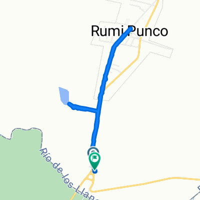
A cycling route starting in Los Altos, Catamarca Province, Argentina.
Overview
About this route
Circuit for the Expedition Mtb event for the race IDesafío al Cañon de Paclin, to be held on October 28, 2012. Mandatory items for participants:
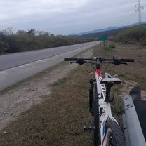
MTB bike in good condition Helmet Gloves Front light or bike light (to cross the 2 km tunnel, very dark) Ziplock bag or similar to protect the race passport. 1/2 lt of water First aid kit
To register or for more information, visit www.ecocatamarca.com.ar
- -:--
- Duration
- 46.8 km
- Distance
- 989 m
- Ascent
- 989 m
- Descent
- ---
- Avg. speed
- ---
- Max. altitude

Continue with Bikemap
Use, edit, or download this cycling route
You would like to ride Desafío al Cañon de Pablin - MTB - Definitivo or customize it for your own trip? Here is what you can do with this Bikemap route:
Free features
- Save this route as favorite or in collections
- Copy & plan your own version of this route
- Sync your route with Garmin or Wahoo
Premium features
Free trial for 3 days, or one-time payment. More about Bikemap Premium.
- Navigate this route on iOS & Android
- Export a GPX / KML file of this route
- Create your custom printout (try it for free)
- Download this route for offline navigation
Discover more Premium features.
Get Bikemap PremiumFrom our community
Other popular routes starting in Los Altos
 Paseo tranqui hasta Rumi.
- Distance
- 6.7 km
- Ascent
- 201 m
- Descent
- 151 m
- Location
- Los Altos, Catamarca Province, Argentina
 Desafío al Cañon de Pablin - MTB - Definitivo
- Distance
- 46.8 km
- Ascent
- 960 m
- Descent
- 960 m
- Location
- Los Altos, Catamarca Province, Argentina
 Alijilan - El Alto (Catamarca)
- Distance
- 31.5 km
- Ascent
- 825 m
- Descent
- 405 m
- Location
- Los Altos, Catamarca Province, Argentina
 Rotonda Huacra - Punto más alto de Cuesta del Totoral
- Distance
- 16.5 km
- Ascent
- 931 m
- Descent
- 289 m
- Location
- Los Altos, Catamarca Province, Argentina
 Desafío al Cañon de Pablin - MTB - Definitivo
- Distance
- 46.8 km
- Ascent
- 989 m
- Descent
- 989 m
- Location
- Los Altos, Catamarca Province, Argentina
 Los Altos Sumampa
- Distance
- 7.7 km
- Ascent
- 65 m
- Descent
- 6 m
- Location
- Los Altos, Catamarca Province, Argentina
 VUELTA ESCABA - DIA 1 (OPCION 1)
- Distance
- 44.6 km
- Ascent
- 918 m
- Descent
- 517 m
- Location
- Los Altos, Catamarca Province, Argentina
 m.a785433
- Distance
- 3.7 km
- Ascent
- 74 m
- Descent
- 59 m
- Location
- Los Altos, Catamarca Province, Argentina
Open it in the app