Cloppenburger Land mit Hasetal
A cycling route starting in Cappeln, Lower Saxony, Germany.
Overview
About this route
Durch die Felder entlang der Hase
(cloned from route 2290565)
- -:--
- Duration
- 67.4 km
- Distance
- 61 m
- Ascent
- 58 m
- Descent
- ---
- Avg. speed
- ---
- Avg. speed
Route quality
Waytypes & surfaces along the route
Waytypes
Path
28.2 km
(42 %)
Quiet road
27.4 km
(41 %)
Surfaces
Paved
62.3 km
(92 %)
Unpaved
3 km
(4 %)
Asphalt
55.4 km
(82 %)
Paving stones
6.8 km
(10 %)
Continue with Bikemap
Use, edit, or download this cycling route
You would like to ride Cloppenburger Land mit Hasetal or customize it for your own trip? Here is what you can do with this Bikemap route:
Free features
- Save this route as favorite or in collections
- Copy & plan your own version of this route
- Sync your route with Garmin or Wahoo
Premium features
Free trial for 3 days, or one-time payment. More about Bikemap Premium.
- Navigate this route on iOS & Android
- Export a GPX / KML file of this route
- Create your custom printout (try it for free)
- Download this route for offline navigation
Discover more Premium features.
Get Bikemap PremiumFrom our community
Other popular routes starting in Cappeln
- Cloppenburger Land mit Hasetal
- Distance
- 67.4 km
- Ascent
- 61 m
- Descent
- 58 m
- Location
- Cappeln, Lower Saxony, Germany
- Cappeln-Hemmelte-Stapelfeld-Sevelten
- Distance
- 31.4 km
- Ascent
- 47 m
- Descent
- 45 m
- Location
- Cappeln, Lower Saxony, Germany
- Cappeln
- Distance
- 18.2 km
- Ascent
- 67 m
- Descent
- 67 m
- Location
- Cappeln, Lower Saxony, Germany
- Cappeln-Hemmelte-Molbergen-Staatsforsten
- Distance
- 44 km
- Ascent
- 63 m
- Descent
- 61 m
- Location
- Cappeln, Lower Saxony, Germany
- Cloppenburger Land mit Ahlhorner Fischteiche
- Distance
- 47.3 km
- Ascent
- 64 m
- Descent
- 67 m
- Location
- Cappeln, Lower Saxony, Germany
- Ahlhorner Fischteiche
- Distance
- 39.6 km
- Ascent
- 78 m
- Descent
- 76 m
- Location
- Cappeln, Lower Saxony, Germany
- Von Cappeln an die Hase
- Distance
- 68.5 km
- Ascent
- 107 m
- Descent
- 108 m
- Location
- Cappeln, Lower Saxony, Germany
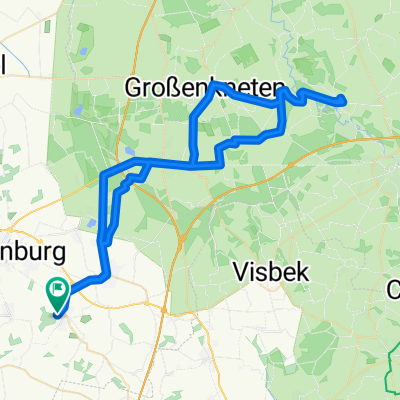
- Cappeln-Elsten-Lüsche-Bakum-Schwichteler
- Distance
- 34.1 km
- Ascent
- 48 m
- Descent
- 49 m
- Location
- Cappeln, Lower Saxony, Germany
Open it in the app