

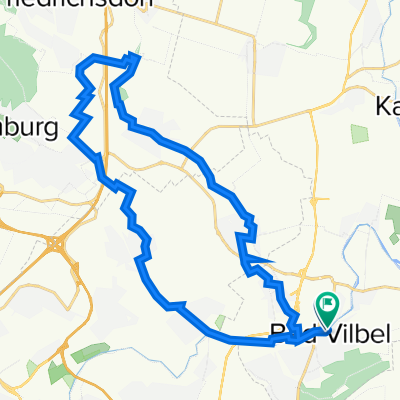
Altenstadt-Runde (RB 064-450)
A cycling route starting in Bad Vilbel, Hesse, Germany.
Overview
About this route
Rennradrunde über die Hohe Straße zum Vulkanradweg bei Altenstadt. Von dort weiter nach Staden an der Nidda und zurück über den Nidda-Radweg bis Karben und weiter zur Hohen Straße.
(cloned from route 2931094)
- -:--
- Duration
- 63.7 km
- Distance
- 318 m
- Ascent
- 317 m
- Descent
- ---
- Avg. speed
- ---
- Max. altitude
Route quality
Waytypes & surfaces along the route
Waytypes
Track
34.8 km
(55 %)
Quiet road
8.7 km
(14 %)
Surfaces
Paved
62.9 km
(99 %)
Unpaved
0.5 km
(<1 %)
Asphalt
62.1 km
(97 %)
Paving stones
0.8 km
(1 %)
Continue with Bikemap
Use, edit, or download this cycling route
You would like to ride Altenstadt-Runde (RB 064-450) or customize it for your own trip? Here is what you can do with this Bikemap route:
Free features
- Save this route as favorite or in collections
- Copy & plan your own version of this route
- Sync your route with Garmin or Wahoo
Premium features
Free trial for 3 days, or one-time payment. More about Bikemap Premium.
- Navigate this route on iOS & Android
- Export a GPX / KML file of this route
- Create your custom printout (try it for free)
- Download this route for offline navigation
Discover more Premium features.
Get Bikemap PremiumFrom our community
Other popular routes starting in Bad Vilbel
 Rundkurs ab Enkheim
- Distance
- 47.8 km
- Ascent
- 278 m
- Descent
- 285 m
- Location
- Bad Vilbel, Hesse, Germany
 RR Schnelle Feierabendrunde Frankfurt/Wetterau
- Distance
- 44 km
- Ascent
- 292 m
- Descent
- 276 m
- Location
- Bad Vilbel, Hesse, Germany
 Lange Radrunde durch Frankfurt am Main
- Distance
- 49.1 km
- Ascent
- 294 m
- Descent
- 288 m
- Location
- Bad Vilbel, Hesse, Germany
 Ronneburgrunde - ca. 550 Hm
- Distance
- 87.9 km
- Ascent
- 596 m
- Descent
- 564 m
- Location
- Bad Vilbel, Hesse, Germany
 Eschbach-Erlenbach
- Distance
- 26.8 km
- Ascent
- 92 m
- Descent
- 91 m
- Location
- Bad Vilbel, Hesse, Germany
 Afterworkroute 5 - ca. 190 Hm
- Distance
- 40.4 km
- Ascent
- 238 m
- Descent
- 224 m
- Location
- Bad Vilbel, Hesse, Germany
 Büdinger-Runde M (RB 091-0450)
- Distance
- 93.1 km
- Ascent
- 314 m
- Descent
- 313 m
- Location
- Bad Vilbel, Hesse, Germany
 Ronneburgrunde südlich (RB 073 - 0340)
- Distance
- 73.2 km
- Ascent
- 321 m
- Descent
- 321 m
- Location
- Bad Vilbel, Hesse, Germany
Open it in the app