

Кольцо по Пятёрке и набережной
A cycling route starting in Yaroslavl, Yaroslavl Oblast, Russia.
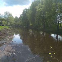
Overview
About this route
Overall, the route is suitable for a cyclist below average skill level, provided they are not afraid of roads.
The road along Chkalova Street is quite comfortable – there is enough space and no turns. Uglichskaya and Chekhova Streets are a bit worse, sometimes you have to squeeze to the edge. At the Privokzalnoye roundabout, drivers won’t yield, so you just have to wait. Ukhtomskogo Street and the beginning of Bolshaya Oktyabrskaya Street are quite convenient. The intersection with Tolbukhin Avenue is very unpleasant – it’s better to go straight since turning onto the embankment is easier from Volodarskogo Street.
The Kotoroslnaya embankment, the spur, and the Volga embankment are just paradise for cyclists. Moreover, the Volga embankment has marked bike lanes, although mostly used by pedestrians.
A minor issue is the climb up a long staircase at the end of the embankment – it’s quite high.
Riding along Lenin Avenue is comfortable, although you have to pass through two traffic lights.
- 1 h
- Duration
- 16.2 km
- Distance
- 55 m
- Ascent
- 54 m
- Descent
- 16.2 km/h
- Avg. speed
- ---
- Max. altitude

Route quality
Waytypes & surfaces along the route
Waytypes
Pedestrian area
7.3 km
(45 %)
Access road
2.4 km
(15 %)
Surfaces
Paved
8.9 km
(55 %)
Asphalt
8.3 km
(51 %)
Paved (undefined)
0.6 km
(4 %)
Undefined
7.3 km
(45 %)
Continue with Bikemap
Use, edit, or download this cycling route
You would like to ride Кольцо по Пятёрке и набережной or customize it for your own trip? Here is what you can do with this Bikemap route:
Free features
- Save this route as favorite or in collections
- Copy & plan your own version of this route
- Sync your route with Garmin or Wahoo
Premium features
Free trial for 3 days, or one-time payment. More about Bikemap Premium.
- Navigate this route on iOS & Android
- Export a GPX / KML file of this route
- Create your custom printout (try it for free)
- Download this route for offline navigation
Discover more Premium features.
Get Bikemap PremiumFrom our community
Other popular routes starting in Yaroslavl
 Расслабленный маршрут в деревне
- Distance
- 7.8 km
- Ascent
- 65 m
- Descent
- 40 m
- Location
- Yaroslavl, Yaroslavl Oblast, Russia
 Из Толги в Брагино
- Distance
- 17.7 km
- Ascent
- 59 m
- Descent
- 27 m
- Location
- Yaroslavl, Yaroslavl Oblast, Russia
 Быстрый путь до Элеваторов
- Distance
- 19.9 km
- Ascent
- 90 m
- Descent
- 68 m
- Location
- Yaroslavl, Yaroslavl Oblast, Russia
 Маршрут 1
- Distance
- 15.5 km
- Ascent
- 119 m
- Descent
- 123 m
- Location
- Yaroslavl, Yaroslavl Oblast, Russia
 От проспект Машиностроителей 27, Ярославль до 5-й Хуторской переулок 18, Ярославль
- Distance
- 52 km
- Ascent
- 188 m
- Descent
- 190 m
- Location
- Yaroslavl, Yaroslavl Oblast, Russia
 От 5-й Хуторской переулок 18, Ярославль до 5-й Хуторской переулок 16, Ярославль
- Distance
- 18.7 km
- Ascent
- 170 m
- Descent
- 163 m
- Location
- Yaroslavl, Yaroslavl Oblast, Russia
 Кольцо по Пятёрке и набережной
- Distance
- 16.2 km
- Ascent
- 55 m
- Descent
- 54 m
- Location
- Yaroslavl, Yaroslavl Oblast, Russia
 От улица Панфилова 9а, Ярославль до улица Елены Колесовой 14, Ярославль
- Distance
- 85.9 km
- Ascent
- 196 m
- Descent
- 199 m
- Location
- Yaroslavl, Yaroslavl Oblast, Russia
Open it in the app