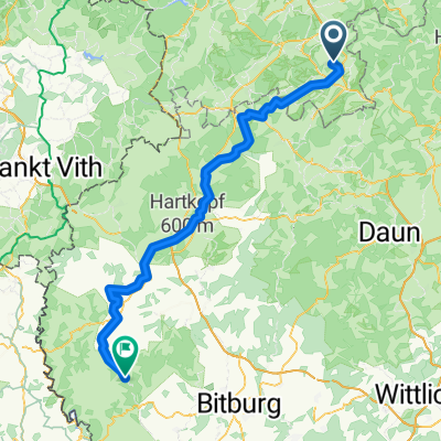
14Eif3Waimes80
A cycling route starting in Ohlenhard, Rhineland-Palatinate, Germany.
Overview
About this route
kampeertrektocht
(cloned from route 2780768)
- -:--
- Duration
- 79 km
- Distance
- 730 m
- Ascent
- 633 m
- Descent
- ---
- Avg. speed
- ---
- Max. altitude
Route quality
Waytypes & surfaces along the route
Waytypes
Road
24.5 km
(31 %)
Track
24.5 km
(31 %)
Surfaces
Paved
35.6 km
(45 %)
Unpaved
7.1 km
(9 %)
Asphalt
32.4 km
(41 %)
Gravel
4 km
(5 %)
Route highlights
Points of interest along the route
Point of interest after 79 km
Camping Anderegg Waimes
Continue with Bikemap
Use, edit, or download this cycling route
You would like to ride 14Eif3Waimes80 or customize it for your own trip? Here is what you can do with this Bikemap route:
Free features
- Save this route as favorite or in collections
- Copy & plan your own version of this route
- Sync your route with Garmin or Wahoo
Premium features
Free trial for 3 days, or one-time payment. More about Bikemap Premium.
- Navigate this route on iOS & Android
- Export a GPX / KML file of this route
- Create your custom printout (try it for free)
- Download this route for offline navigation
Discover more Premium features.
Get Bikemap PremiumFrom our community
Other popular routes starting in Ohlenhard
Mechernicher Straße 5, Nettersheim nach In der Freiheit 17, Swisttal- Distance
- 29.4 km
- Ascent
- 79 m
- Descent
- 452 m
- Location
- Ohlenhard, Rhineland-Palatinate, Germany
Route nach Am Freilinger See 300, Blankenheim- Distance
- 24.4 km
- Ascent
- 394 m
- Descent
- 402 m
- Location
- Ohlenhard, Rhineland-Palatinate, Germany
Bachgeflüster- Distance
- 31.3 km
- Ascent
- 479 m
- Descent
- 479 m
- Location
- Ohlenhard, Rhineland-Palatinate, Germany
Rurtalsperre in der Eifel- Distance
- 78.4 km
- Ascent
- 820 m
- Descent
- 1,007 m
- Location
- Ohlenhard, Rhineland-Palatinate, Germany
Freilingersee- Distance
- 36.7 km
- Ascent
- 427 m
- Descent
- 426 m
- Location
- Ohlenhard, Rhineland-Palatinate, Germany
14Eif3Waimes80- Distance
- 79 km
- Ascent
- 730 m
- Descent
- 633 m
- Location
- Ohlenhard, Rhineland-Palatinate, Germany
Rondje vanuit Freilingersee- Distance
- 61 km
- Ascent
- 992 m
- Descent
- 998 m
- Location
- Ohlenhard, Rhineland-Palatinate, Germany
Tagestour Freilingen- Distance
- 50.2 km
- Ascent
- 620 m
- Descent
- 623 m
- Location
- Ohlenhard, Rhineland-Palatinate, Germany
Open it in the app

