Radtour 2022 Et2
- 83.1 km
- 876 m
- 820 m
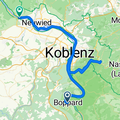
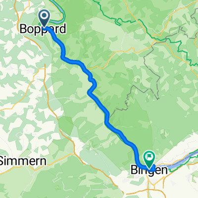
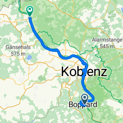
- Boppard, Rhineland-Palatinate, Germany
A cycling route starting in Boppard, Rhineland-Palatinate, Germany.
Overview
TEASI track
created this 10 years ago
Route quality
Path
9 km
(38 %)
Access road
6.4 km
(27 %)
Paved
12.6 km
(53 %)
Unpaved
1.9 km
(8 %)
Asphalt
11.7 km
(49 %)
Gravel
1.9 km
(8 %)
Continue with Bikemap
You would like to ride Boppard - Koblenz-Goldgrube (Heim).gpx or customize it for your own trip? Here is what you can do with this Bikemap route:
Free trial for 3 days, or one-time payment. More about Bikemap Premium.
Discover more Premium features.
Get Bikemap PremiumFrom our community
Open it in the app