

Sabbionara-AcqueNere-Altissimo-Corno
A cycling route starting in Sabbionara, Trentino-Alto Adige, Italy.
Overview
About this route
Challenging route with 4000m of elevation gain.
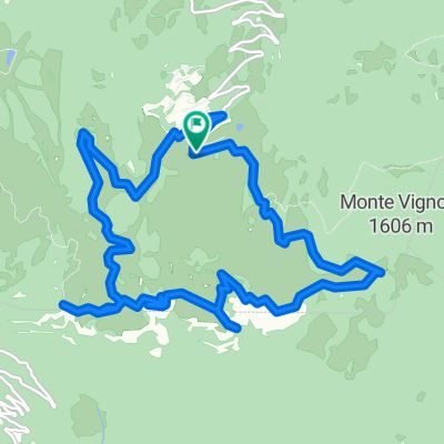
From Sabbionara, head towards San Valentino, continue to Pra Alpesina. Turn towards Garda Novezza. At Malga Artilon, take the dirt road to Malga Acque Nere. After the malga, take the singletrack on the left to Madonna della Neve.
Continue towards Avio via the Pian della Cenere trail.
After a challenging descent, resume on asphalt and climb up to S. Valentino.
Go straight on to the Graziani refuge and take the steep dirt road that climbs Monte Altissimo.
From the refuge, descend to Malga Campo and then to S. Giacomo.
Climb back to S. Valentino and continue towards "pra vec". Upon reaching Corno della Paura, take trail 686 towards Bocca d'Ardole to return to Sabbionara.
- -:--
- Duration
- 74 km
- Distance
- 3,390 m
- Ascent
- 3,375 m
- Descent
- ---
- Avg. speed
- ---
- Max. altitude

Continue with Bikemap
Use, edit, or download this cycling route
You would like to ride Sabbionara-AcqueNere-Altissimo-Corno or customize it for your own trip? Here is what you can do with this Bikemap route:
Free features
- Save this route as favorite or in collections
- Copy & plan your own version of this route
- Sync your route with Garmin or Wahoo
Premium features
Free trial for 3 days, or one-time payment. More about Bikemap Premium.
- Navigate this route on iOS & Android
- Export a GPX / KML file of this route
- Create your custom printout (try it for free)
- Download this route for offline navigation
Discover more Premium features.
Get Bikemap PremiumFrom our community
Other popular routes starting in Sabbionara
 Sabbionara Corno della Paura
- Distance
- 27.7 km
- Ascent
- 1,424 m
- Descent
- 1,409 m
- Location
- Sabbionara, Trentino-Alto Adige, Italy
 Passo Fittanze
- Distance
- 13.9 km
- Ascent
- 1,232 m
- Descent
- 4 m
- Location
- Sabbionara, Trentino-Alto Adige, Italy
 Corno della paura
- Distance
- 13.8 km
- Ascent
- 1,286 m
- Descent
- 1,286 m
- Location
- Sabbionara, Trentino-Alto Adige, Italy
 Corno della Paura Trails
- Distance
- 32.6 km
- Ascent
- 2,305 m
- Descent
- 2,304 m
- Location
- Sabbionara, Trentino-Alto Adige, Italy
 Aquile in Lessinia 5/9/2015
- Distance
- 19.6 km
- Ascent
- 348 m
- Descent
- 326 m
- Location
- Sabbionara, Trentino-Alto Adige, Italy
 Avio Torbole
- Distance
- 28.4 km
- Ascent
- 182 m
- Descent
- 242 m
- Location
- Sabbionara, Trentino-Alto Adige, Italy
 Sdruzzina- Sega
- Distance
- 11.7 km
- Ascent
- 1,181 m
- Descent
- 47 m
- Location
- Sabbionara, Trentino-Alto Adige, Italy
 Giro del Baldo
- Distance
- 86.9 km
- Ascent
- 1,777 m
- Descent
- 1,777 m
- Location
- Sabbionara, Trentino-Alto Adige, Italy
Open it in the app