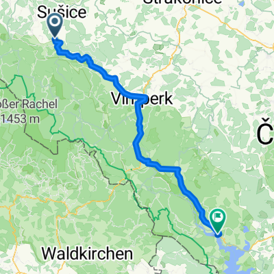
Jiřičná - Keply - Hory Matky Boží - Jiřičná
A cycling route starting in Hartmanice, Plzeňský kraj, Czechia.
Overview
About this route
Trasa oddychová, nenáročná, s prekrásnymi výhľadmi do krajiny, čiastočne kopírujúca značenú Farmársku cestu.
- -:--
- Duration
- 36 km
- Distance
- 562 m
- Ascent
- 566 m
- Descent
- ---
- Avg. speed
- ---
- Avg. speed
Continue with Bikemap
Use, edit, or download this cycling route
You would like to ride Jiřičná - Keply - Hory Matky Boží - Jiřičná or customize it for your own trip? Here is what you can do with this Bikemap route:
Free features
- Save this route as favorite or in collections
- Copy & plan your own version of this route
- Sync your route with Garmin or Wahoo
Premium features
Free trial for 3 days, or one-time payment. More about Bikemap Premium.
- Navigate this route on iOS & Android
- Export a GPX / KML file of this route
- Create your custom printout (try it for free)
- Download this route for offline navigation
Discover more Premium features.
Get Bikemap PremiumFrom our community
Other popular routes starting in Hartmanice
- na poledník
- Distance
- 7.8 km
- Ascent
- 465 m
- Descent
- 38 m
- Location
- Hartmanice, Plzeňský kraj, Czechia
- PPP4_Petrovice_Plzeň_2010_7_28
- Distance
- 85.9 km
- Ascent
- 507 m
- Descent
- 733 m
- Location
- Hartmanice, Plzeňský kraj, Czechia
- Šumava po hranici
- Distance
- 20 km
- Ascent
- 677 m
- Descent
- 680 m
- Location
- Hartmanice, Plzeňský kraj, Czechia
- Prášily_Volary
- Distance
- 63.1 km
- Ascent
- 1,137 m
- Descent
- 1,222 m
- Location
- Hartmanice, Plzeňský kraj, Czechia
- Sumava: von Prasily runter nach Nova Pec am Lipno-Stausee
- Distance
- 76.9 km
- Ascent
- 936 m
- Descent
- 1,079 m
- Location
- Hartmanice, Plzeňský kraj, Czechia
- Jiřičná - Železnorudsko a zpět
- Distance
- 80.3 km
- Ascent
- 1,342 m
- Descent
- 1,342 m
- Location
- Hartmanice, Plzeňský kraj, Czechia
- Na Svatobor a poza něj
- Distance
- 35.5 km
- Ascent
- 685 m
- Descent
- 621 m
- Location
- Hartmanice, Plzeňský kraj, Czechia
- 2019_08 Skalka, Poledník, Oblík pěšky
- Distance
- 20.1 km
- Ascent
- 750 m
- Descent
- 641 m
- Location
- Hartmanice, Plzeňský kraj, Czechia
Open it in the app