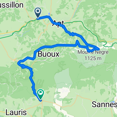
Tour du Lub茅ron
A cycling route starting in Gargas, Provence-Alpes-C么te d'Azur Region, France.
Overview
About this route
Small roads circling the Luberon massif
- -:--
- Duration
- 96.9 km
- Distance
- 1,198 m
- Ascent
- 1,203 m
- Descent
- ---
- Avg. speed
- ---
- Max. altitude
Route quality
Waytypes & surfaces along the route
Waytypes
Road
54.2 km
(56 %)
Quiet road
18.4 km
(19 %)
Surfaces
Paved
55.2 km
(57 %)
Unpaved
1 km
(1 %)
Asphalt
55.2 km
(57 %)
Unpaved (undefined)
1 km
(1 %)
Undefined
40.7 km
(42 %)
Continue with Bikemap
Use, edit, or download this cycling route
You would like to ride Tour du Lub茅ron or customize it for your own trip? Here is what you can do with this Bikemap route:
Free features
- Save this route as favorite or in collections
- Copy & plan your own version of this route
- Split it into stages to create a multi-day tour
- Sync your route with Garmin or Wahoo
Premium features
Free trial for 3 days, or one-time payment. More about Bikemap Premium.
- Navigate this route on iOS & Android
- Export a GPX / KML file of this route
- Create your custom printout (try it for free)
- Download this route for offline navigation
Discover more Premium features.
Get Bikemap PremiumFrom our community
Other popular routes starting in Gargas
Tour du Lub茅ron- Distance
- 96.9 km
- Ascent
- 1,198 m
- Descent
- 1,203 m
- Location
- Gargas, Provence-Alpes-C么te d'Azur Region, France
Provence: Colorado Provencal- Distance
- 47.6 km
- Ascent
- 731 m
- Descent
- 687 m
- Location
- Gargas, Provence-Alpes-C么te d'Azur Region, France
55K 960D+ perfect short 'n hilly ride- Distance
- 54.3 km
- Ascent
- 1,006 m
- Descent
- 1,005 m
- Location
- Gargas, Provence-Alpes-C么te d'Azur Region, France
Provence: 脺ber den Kamm des Kleinen Luberon- Distance
- 76.4 km
- Ascent
- 1,431 m
- Descent
- 1,482 m
- Location
- Gargas, Provence-Alpes-C么te d'Azur Region, France
Luberon 1- Distance
- 114.2 km
- Ascent
- 1,616 m
- Descent
- 1,515 m
- Location
- Gargas, Provence-Alpes-C么te d'Azur Region, France
Gargas-Gorges de la Nesque- Distance
- 94.8 km
- Ascent
- 1,354 m
- Descent
- 1,328 m
- Location
- Gargas, Provence-Alpes-C么te d'Azur Region, France
Gargas-Gargas 2- Distance
- 81.7 km
- Ascent
- 1,153 m
- Descent
- 1,145 m
- Location
- Gargas, Provence-Alpes-C么te d'Azur Region, France
Provence: Wald von Saint Lambert- Distance
- 58.8 km
- Ascent
- 988 m
- Descent
- 988 m
- Location
- Gargas, Provence-Alpes-C么te d'Azur Region, France
Open it in the app


