

Half Moon Bay International Triathlon
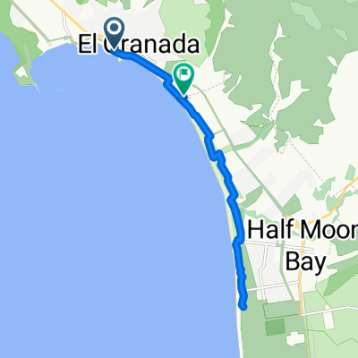
A cycling route starting in El Granada, California, United States.
Overview
About this route
Bike course for the Half Moon Bay International Triathlon
- -:--
- Duration
- 40 km
- Distance
- 107 m
- Ascent
- 111 m
- Descent
- ---
- Avg. speed
- ---
- Max. altitude
Route quality
Waytypes & surfaces along the route
Waytypes
Cycleway
22.2 km
(55 %)
Busy road
5 km
(13 %)
Surfaces
Paved
22.6 km
(56 %)
Unpaved
0 km
(<1 %)
Asphalt
22.6 km
(56 %)
Ground
0 km
(<1 %)
Undefined
17.4 km
(44 %)
Continue with Bikemap
Use, edit, or download this cycling route
You would like to ride Half Moon Bay International Triathlon or customize it for your own trip? Here is what you can do with this Bikemap route:
Free features
- Save this route as favorite or in collections
- Copy & plan your own version of this route
- Sync your route with Garmin or Wahoo
Premium features
Free trial for 3 days, or one-time payment. More about Bikemap Premium.
- Navigate this route on iOS & Android
- Export a GPX / KML file of this route
- Create your custom printout (try it for free)
- Download this route for offline navigation
Discover more Premium features.
Get Bikemap PremiumFrom our community
Other popular routes starting in El Granada
 Princeton la costanera
- Distance
- 8.7 km
- Ascent
- 110 m
- Descent
- 73 m
- Location
- El Granada, California, United States
 Half Moon Bay International Triathlon
- Distance
- 40 km
- Ascent
- 107 m
- Descent
- 111 m
- Location
- El Granada, California, United States
 Half Moon Bay Coastal Bike Trail
- Distance
- 27.6 km
- Ascent
- 55 m
- Descent
- 55 m
- Location
- El Granada, California, United States
 Columbus Street 1195, El Granada to Columbus Street 1195, El Granada
- Distance
- 4.8 km
- Ascent
- 142 m
- Descent
- 120 m
- Location
- El Granada, California, United States
 Pillar Point Harbor Trail, Half Moon Bay to Mirada Rd, Half Moon Bay
- Distance
- 13.2 km
- Ascent
- 26 m
- Descent
- 18 m
- Location
- El Granada, California, United States
 Pillar Point Harbor Blvd, Half Moon Bay to 9 Johnson Pier, Half Moon Bay
- Distance
- 21.3 km
- Ascent
- 0 m
- Descent
- 3 m
- Location
- El Granada, California, United States
 Pillar Point harbor to Ritz HMB
- Distance
- 12.2 km
- Ascent
- 74 m
- Descent
- 65 m
- Location
- El Granada, California, United States
 Epic Coastal Woodside route.
- Distance
- 101.9 km
- Ascent
- 1,309 m
- Descent
- 1,306 m
- Location
- El Granada, California, United States
Open it in the app