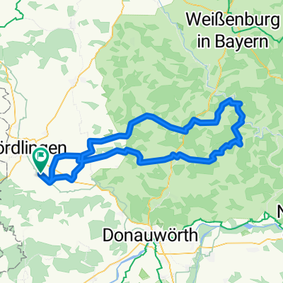
ReimlingenAalen48_1000
A cycling route starting in Reimlingen, Bavaria, Germany.
Overview
About this route
Von Reimlingen nach Aalen und zurück
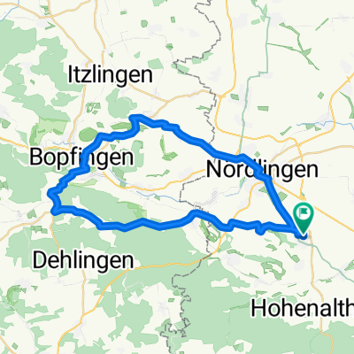
- -:--
- Duration
- 47.4 km
- Distance
- 558 m
- Ascent
- 561 m
- Descent
- ---
- Avg. speed
- ---
- Max. altitude
Route quality
Waytypes & surfaces along the route
Waytypes
Road
18.5 km
(39 %)
Track
9.5 km
(20 %)
Surfaces
Paved
41.3 km
(87 %)
Unpaved
1.9 km
(4 %)
Asphalt
37.5 km
(79 %)
Paved (undefined)
3.8 km
(8 %)
Continue with Bikemap
Use, edit, or download this cycling route
You would like to ride ReimlingenAalen48_1000 or customize it for your own trip? Here is what you can do with this Bikemap route:
Free features
- Save this route as favorite or in collections
- Copy & plan your own version of this route
- Sync your route with Garmin or Wahoo
Premium features
Free trial for 3 days, or one-time payment. More about Bikemap Premium.
- Navigate this route on iOS & Android
- Export a GPX / KML file of this route
- Create your custom printout (try it for free)
- Download this route for offline navigation
Discover more Premium features.
Get Bikemap PremiumFrom our community
Other popular routes starting in Reimlingen
- Reimlingen - Goldbergalm
- Distance
- 27.7 km
- Ascent
- 293 m
- Descent
- 226 m
- Location
- Reimlingen, Bavaria, Germany
- Reimlingen - Schweindorf - Reimlingen
- Distance
- 31.9 km
- Ascent
- 491 m
- Descent
- 491 m
- Location
- Reimlingen, Bavaria, Germany
- Ruinenrunde
- Distance
- 20.2 km
- Ascent
- 374 m
- Descent
- 372 m
- Location
- Reimlingen, Bavaria, Germany
- Geotop Lindle - Nördlingen
- Distance
- 16.7 km
- Ascent
- 141 m
- Descent
- 142 m
- Location
- Reimlingen, Bavaria, Germany
- Große Ipfrunde
- Distance
- 39.1 km
- Ascent
- 1,599 m
- Descent
- 1,606 m
- Location
- Reimlingen, Bavaria, Germany
- Reimlingen - Bopfingen
- Distance
- 32.8 km
- Ascent
- 204 m
- Descent
- 205 m
- Location
- Reimlingen, Bavaria, Germany
- Reimlingen- Ederheim-Dehlingen-Dunstelkingen-Eglingen- Christgarten-Reimlingen
- Distance
- 46 km
- Ascent
- 379 m
- Descent
- 380 m
- Location
- Reimlingen, Bavaria, Germany
- Reimlingen - Ofnethöhlen
- Distance
- 18.5 km
- Ascent
- 295 m
- Descent
- 295 m
- Location
- Reimlingen, Bavaria, Germany
Open it in the app