

Rund ums Ammergebirge
A cycling route starting in Unterammergau, Bavaria, Germany.
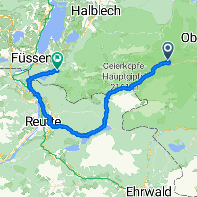
Overview
About this route
There is a lot of traffic on Planseestrasse in good weather... just before the Wieskirche, the bad asphalt turns entirely into gravel (about 500m) but rideable... The tour description was inaccurate after the Wieskirche, so I rode a few more kilometers.
All in all, a nice tour (cloned from route 189064) (cloned from route 2959565)- -:--
- Duration
- 108.6 km
- Distance
- 537 m
- Ascent
- 538 m
- Descent
- ---
- Avg. speed
- ---
- Max. altitude
Route quality
Waytypes & surfaces along the route
Waytypes
Quiet road
42.4 km
(39 %)
Track
9.8 km
(9 %)
Surfaces
Paved
99.9 km
(92 %)
Unpaved
1.1 km
(1 %)
Asphalt
99.9 km
(92 %)
Gravel
1.1 km
(1 %)
Undefined
7.6 km
(7 %)
Continue with Bikemap
Use, edit, or download this cycling route
You would like to ride Rund ums Ammergebirge or customize it for your own trip? Here is what you can do with this Bikemap route:
Free features
- Save this route as favorite or in collections
- Copy & plan your own version of this route
- Split it into stages to create a multi-day tour
- Sync your route with Garmin or Wahoo
Premium features
Free trial for 3 days, or one-time payment. More about Bikemap Premium.
- Navigate this route on iOS & Android
- Export a GPX / KML file of this route
- Create your custom printout (try it for free)
- Download this route for offline navigation
Discover more Premium features.
Get Bikemap PremiumFrom our community
Other popular routes starting in Unterammergau
 Rund ums Ammergebirge
- Distance
- 108.7 km
- Ascent
- 524 m
- Descent
- 525 m
- Location
- Unterammergau, Bavaria, Germany
 Altherrenweg Ogau
- Distance
- 7.4 km
- Ascent
- 161 m
- Descent
- 160 m
- Location
- Unterammergau, Bavaria, Germany
 Linderhof - Neuschwanstein
- Distance
- 39.1 km
- Ascent
- 396 m
- Descent
- 449 m
- Location
- Unterammergau, Bavaria, Germany
 Radtour - Talrunde Kloster Ettal
- Distance
- 18.2 km
- Ascent
- 135 m
- Descent
- 139 m
- Location
- Unterammergau, Bavaria, Germany
 Pürschling hart aber herzlich
- Distance
- 5.4 km
- Ascent
- 700 m
- Descent
- 51 m
- Location
- Unterammergau, Bavaria, Germany
 Um´s Hörnle
- Distance
- 30 km
- Ascent
- 780 m
- Descent
- 780 m
- Location
- Unterammergau, Bavaria, Germany
 Rund ums Ammergebirge
- Distance
- 108.6 km
- Ascent
- 537 m
- Descent
- 538 m
- Location
- Unterammergau, Bavaria, Germany
 Friederspitz
- Distance
- 24.7 km
- Ascent
- 1,186 m
- Descent
- 1,185 m
- Location
- Unterammergau, Bavaria, Germany
Open it in the app