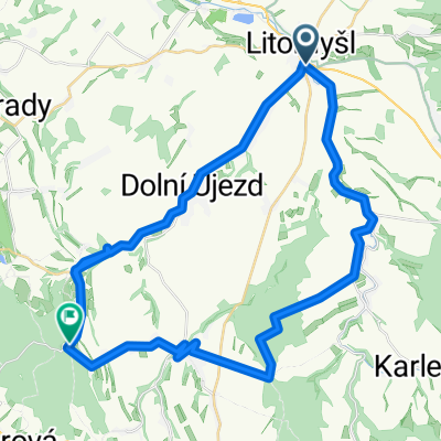
Brandýs-Ústí-Knapovec-Č.Třebová-Semanín-Gajer-Litomyšl
A cycling route starting in Litomyšl, Pardubický kraj, Czechia.
Overview
About this route
trénink
(cloned from route 2183430)
- -:--
- Duration
- 75.9 km
- Distance
- 676 m
- Ascent
- 697 m
- Descent
- ---
- Avg. speed
- ---
- Avg. speed
Route quality
Waytypes & surfaces along the route
Waytypes
Road
45.2 km
(60 %)
Busy road
13.3 km
(18 %)
Surfaces
Paved
23.7 km
(31 %)
Unpaved
1.8 km
(2 %)
Asphalt
18.2 km
(24 %)
Paved (undefined)
5.6 km
(7 %)
Continue with Bikemap
Use, edit, or download this cycling route
You would like to ride Brandýs-Ústí-Knapovec-Č.Třebová-Semanín-Gajer-Litomyšl or customize it for your own trip? Here is what you can do with this Bikemap route:
Free features
- Save this route as favorite or in collections
- Copy & plan your own version of this route
- Sync your route with Garmin or Wahoo
Premium features
Free trial for 3 days, or one-time payment. More about Bikemap Premium.
- Navigate this route on iOS & Android
- Export a GPX / KML file of this route
- Create your custom printout (try it for free)
- Download this route for offline navigation
Discover more Premium features.
Get Bikemap PremiumFrom our community
Other popular routes starting in Litomyšl
- Long ride through Litomyšl
- Distance
- 49.2 km
- Ascent
- 494 m
- Descent
- 501 m
- Location
- Litomyšl, Pardubický kraj, Czechia
- Kozlov
- Distance
- 20.3 km
- Ascent
- 328 m
- Descent
- 328 m
- Location
- Litomyšl, Pardubický kraj, Czechia
- Litomyšl - Choceň - Nové Hrady - Budislav - Litomyšl
- Distance
- 63.1 km
- Ascent
- 544 m
- Descent
- 544 m
- Location
- Litomyšl, Pardubický kraj, Czechia
- 20. Litomyšl - Žďár nad Sázavou (Zel. hora - Pilák)
- Distance
- 55.5 km
- Ascent
- 659 m
- Descent
- 429 m
- Location
- Litomyšl, Pardubický kraj, Czechia
- Brandýs-Ústí-Knapovec-Č.Třebová-Semanín-Gajer-Litomyšl
- Distance
- 75.9 km
- Ascent
- 676 m
- Descent
- 697 m
- Location
- Litomyšl, Pardubický kraj, Czechia
- Nové Hrady- Luže - Budislav
- Distance
- 64 km
- Ascent
- 613 m
- Descent
- 613 m
- Location
- Litomyšl, Pardubický kraj, Czechia
- Litomyšl - Moravským krasem - Olšovec - Lelkovadlo - Bystřice nP - Litomyšl
- Distance
- 264.1 km
- Ascent
- 1,781 m
- Descent
- 1,778 m
- Location
- Litomyšl, Pardubický kraj, Czechia
- Litomyšl-Chocen-Chlum-litomysl
- Distance
- 53.4 km
- Ascent
- 523 m
- Descent
- 525 m
- Location
- Litomyšl, Pardubický kraj, Czechia
Open it in the app