

Weinberge und Ackerland
A cycling route starting in Niederkirchen bei Deidesheim, Rhineland-Palatinate, Germany.
Overview
About this route
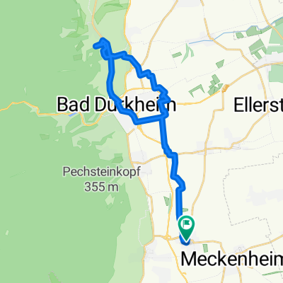
TEASI track from 05.04.2015 From Niederkirchen, it goes to Deidesheim, passing by the fire department equipment house. The tour continues through Forst to Wachenheim, passing the Villa Rustica to Friedelsheim. The return route goes past Gönnheim to Rödersheim-Gronau and over agricultural paths to Hochdorf-Assenheim. From here, the path goes back to Niederkirchen through Meckenheim. It was planned that the tour would only run on paved roads (concrete, asphalt), but it turned out that between Rödersheim-Gronau and Hochdorf-Assenheim there is a short unpaved section of a few hundred meters, requiring passage through deep mud. If this section is bypassed, the route is suitable for any bike.
- -:--
- Duration
- 25.3 km
- Distance
- 61 m
- Ascent
- 64 m
- Descent
- ---
- Avg. speed
- ---
- Max. altitude

Route quality
Waytypes & surfaces along the route
Waytypes
Track
16.5 km
(65 %)
Quiet road
6.1 km
(24 %)
Surfaces
Paved
21.3 km
(84 %)
Unpaved
1.3 km
(5 %)
Asphalt
11.7 km
(46 %)
Paved (undefined)
5.1 km
(20 %)
Route highlights
Points of interest along the route
Point of interest after 2.8 km
Feuerwehrgerätehaus Deidesheim
Point of interest after 8.9 km
Villa Rustica Eine "villa rustica" ist die Bezeichnung für ein römisches Landgut. Die Villa rustica Wachenheim wurde 1980 bei der Flurbereinigung entdeckt und in der Folgezeit durch die Archäologische Denkmalpflege Speyer nahezu vollständig ausgegraben und die Gebäudereste restauriert. Mehr unter: http://www.villa-rustica-wachenheim.de/
Point of interest after 24.9 km
Pfarrkirche St. Martin in Niederkirchen
Continue with Bikemap
Use, edit, or download this cycling route
You would like to ride Weinberge und Ackerland or customize it for your own trip? Here is what you can do with this Bikemap route:
Free features
- Save this route as favorite or in collections
- Copy & plan your own version of this route
- Sync your route with Garmin or Wahoo
Premium features
Free trial for 3 days, or one-time payment. More about Bikemap Premium.
- Navigate this route on iOS & Android
- Export a GPX / KML file of this route
- Create your custom printout (try it for free)
- Download this route for offline navigation
Discover more Premium features.
Get Bikemap PremiumFrom our community
Other popular routes starting in Niederkirchen bei Deidesheim
 Weinberge und Ackerland
- Distance
- 25.3 km
- Ascent
- 61 m
- Descent
- 64 m
- Location
- Niederkirchen bei Deidesheim, Rhineland-Palatinate, Germany
 Michaelskapelle - Heidenlöcher - Am Weißenstich
- Distance
- 28.1 km
- Ascent
- 574 m
- Descent
- 574 m
- Location
- Niederkirchen bei Deidesheim, Rhineland-Palatinate, Germany
 Am Weißentsich - Wachenheim
- Distance
- 29.6 km
- Ascent
- 487 m
- Descent
- 487 m
- Location
- Niederkirchen bei Deidesheim, Rhineland-Palatinate, Germany
 Niederkirchen - Weisenheim am Sand
- Distance
- 44 km
- Ascent
- 113 m
- Descent
- 113 m
- Location
- Niederkirchen bei Deidesheim, Rhineland-Palatinate, Germany
 Durchs Wachenheimer Tal nach NW
- Distance
- 35.7 km
- Ascent
- 600 m
- Descent
- 583 m
- Location
- Niederkirchen bei Deidesheim, Rhineland-Palatinate, Germany
 Niederkirchen - Leistadt
- Distance
- 25.4 km
- Ascent
- 201 m
- Descent
- 198 m
- Location
- Niederkirchen bei Deidesheim, Rhineland-Palatinate, Germany
 Niederkrichen - Bad Dürkheim.gpx
- Distance
- 16.6 km
- Ascent
- 55 m
- Descent
- 52 m
- Location
- Niederkirchen bei Deidesheim, Rhineland-Palatinate, Germany
 Kreuz und Quer durch die Weinberge
- Distance
- 22.1 km
- Ascent
- 165 m
- Descent
- 165 m
- Location
- Niederkirchen bei Deidesheim, Rhineland-Palatinate, Germany
Open it in the app