

Abendrunde Freilassing - Surheim
- 21 km
- 128 m
- 128 m
- Freilassing, Bavaria, Germany
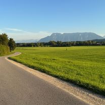
A cycling route starting in Freilassing, Bavaria, Germany.
Overview
Moderate inclines. For mountain biking or similar. Not suitable for road bikes. Route: Almost exclusively secondary roads. Partly gravel roads. Mostly landscapes and nature reserves.
Passes by or through the following areas:
Ainringer Moos Haarmoos Abstorfer See Schönramer Filz Surspeicher with its ponds Höglwörther See Anger
Continue with Bikemap
You would like to ride Moos -u. Moorweg or customize it for your own trip? Here is what you can do with this Bikemap route:
Free trial for 3 days, or one-time payment. More about Bikemap Premium.
Discover more Premium features.
Get Bikemap PremiumFrom our community
Open it in the app


