
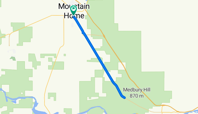
2015 Idaho State Championship TT course
A cycling route starting in Mountain Home, Idaho, United States.
Overview
About this route
This will be an out and back course. Start and finish will be just east on Old Hwy 30 with its intersection with South 3rd West A Street. Turn arounds for 10K, 20K and 40K will be marked with a different color, wash off in rain paint.
- -:--
- Duration
- 40.3 km
- Distance
- 76 m
- Ascent
- 76 m
- Descent
- ---
- Avg. speed
- ---
- Max. altitude
Route quality
Waytypes & surfaces along the route
Waytypes
Track
4.4 km
(11 %)
Access road
2.4 km
(6 %)
Surfaces
Paved
24.2 km
(60 %)
Asphalt
24.2 km
(60 %)
Undefined
16.1 km
(40 %)
Route highlights
Points of interest along the route
Point of interest after 0 km
Approximate Start and Finish for State TT
Point of interest after 20.1 km
Turn around for 40 K riders
Point of interest after 30.1 km
Turn around for 20 K riders
Point of interest after 35.3 km
Turn around for 10 K riders
Continue with Bikemap
Use, edit, or download this cycling route
You would like to ride 2015 Idaho State Championship TT course or customize it for your own trip? Here is what you can do with this Bikemap route:
Free features
- Save this route as favorite or in collections
- Copy & plan your own version of this route
- Sync your route with Garmin or Wahoo
Premium features
Free trial for 3 days, or one-time payment. More about Bikemap Premium.
- Navigate this route on iOS & Android
- Export a GPX / KML file of this route
- Create your custom printout (try it for free)
- Download this route for offline navigation
Discover more Premium features.
Get Bikemap PremiumFrom our community
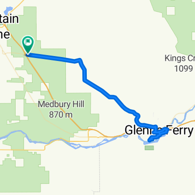
Other popular routes starting in Mountain Home
 HILL 20mph
- Distance
- 0.5 km
- Ascent
- 3 m
- Descent
- 6 m
- Location
- Mountain Home, Idaho, United States
 Old Oregon Trail Loop
- Distance
- 79.5 km
- Ascent
- 2,818 m
- Descent
- 2,824 m
- Location
- Mountain Home, Idaho, United States
 Teapot v0.1
- Distance
- 67.9 km
- Ascent
- 284 m
- Descent
- 288 m
- Location
- Mountain Home, Idaho, United States
 250-> MOUNTAIN HOME - TWIN FALLS
- Distance
- 155.4 km
- Ascent
- 612 m
- Descent
- 435 m
- Location
- Mountain Home, Idaho, United States
 035 USA 07072012
- Distance
- 68.6 km
- Ascent
- 144 m
- Descent
- 242 m
- Location
- Mountain Home, Idaho, United States
 2729–2793 American Legion Blvd, Mountain Home to 2795–2851 American Legion Blvd, Mountain Home
- Distance
- 8.9 km
- Ascent
- 70 m
- Descent
- 79 m
- Location
- Mountain Home, Idaho, United States
 2795–2851 American Legion Blvd, Mountain Home to 2795–2851 American Legion Blvd, Mountain Home
- Distance
- 9.4 km
- Ascent
- 37 m
- Descent
- 41 m
- Location
- Mountain Home, Idaho, United States
 West 4th North 505, Mountain Home to W. 5th N. St/N Haskett St, Mountain Home
- Distance
- 3.5 km
- Ascent
- 0 m
- Descent
- 0 m
- Location
- Mountain Home, Idaho, United States
Open it in the app