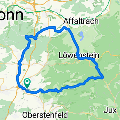
Abstatt-Stettenfels-Köpferbrunnen-Schanzenweg-Köpferstausee

A cycling route starting in Abstatt, Baden-Wurttemberg, Germany.
OverviewAbout this route

Abstatt-Stettenfels-Köpferbrunnen-Schanzenweg-Köpferstausee

Translated, show original (German)
-:--
Duration
31.1 km
Distance
441 m
Ascent
440 m
Descent
---
Avg. speed
---
Max. altitude
Ramrod Infantrycreated this 11 years ago
Route qualityWaytypes & surfaces along the route
Waytypes
  • Track

    17.1 km55 %
  • Path

    10 km32 %
  • Quiet road

    3.1 km10 %
Surfaces

Paved

10.3 km(33 %)

Unpaved

20.2 km(65 %)
  • Asphalt

    9.7 km31 %
  • Ground

    9.3 km30 %
  • Gravel

    6.5 km21 %
Continue with BikemapUse, edit, or download this cycling route
You would like to ride Abstatt-Stettenfels-Köpferbrunnen-Schanzenweg-Köpferstausee or customize it for your own trip? Here is what you can do with this Bikemap route:
Free features
Premium features

Free trial for 3 days, or one-time payment. More about Bikemap Premium.

  • Navigate this route on iOS & Android
  • Export a GPX / KML file of this route
  • Create your custom printout (try it for free)
  • Download this route for offline navigation

Discover more Premium features.

Get Bikemap Premium
From our communityOther popular routes starting in Abstatt

Open it in the app