

Pilgrims Hatch - Toot Hill - Highwood - &Back
A cycling route starting in Brentwood, England, United Kingdom.
Overview
About this route
Pilgrims Hatch
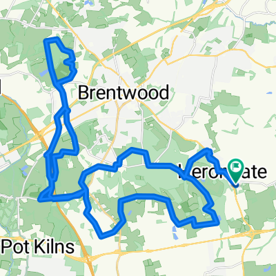
Navestock Side London Road Toot Hill Greensted Stondon Massey Blackmore Highwood Blackmore Ingatestone Road Mill Lane Church lane Doddinghurst Days Lane Pilgrims hatch - -:--
- Duration
- 42.5 km
- Distance
- 267 m
- Ascent
- 267 m
- Descent
- ---
- Avg. speed
- ---
- Max. altitude

Route quality
Waytypes & surfaces along the route
Waytypes
Road
21.1 km
(50 %)
Quiet road
20.7 km
(49 %)
Surfaces
Paved
1.2 km
(3 %)
Unpaved
0.4 km
(<1 %)
Asphalt
1.2 km
(3 %)
Ground
0.4 km
(<1 %)
Undefined
40.9 km
(96 %)
Continue with Bikemap
Use, edit, or download this cycling route
You would like to ride Pilgrims Hatch - Toot Hill - Highwood - &Back or customize it for your own trip? Here is what you can do with this Bikemap route:
Free features
- Save this route as favorite or in collections
- Copy & plan your own version of this route
- Sync your route with Garmin or Wahoo
Premium features
Free trial for 3 days, or one-time payment. More about Bikemap Premium.
- Navigate this route on iOS & Android
- Export a GPX / KML file of this route
- Create your custom printout (try it for free)
- Download this route for offline navigation
Discover more Premium features.
Get Bikemap PremiumFrom our community
Other popular routes starting in Brentwood
 A Saturday ride
- Distance
- 16.3 km
- Ascent
- 172 m
- Descent
- 173 m
- Location
- Brentwood, England, United Kingdom
 Hills!
- Distance
- 37.2 km
- Ascent
- 1,070 m
- Descent
- 1,069 m
- Location
- Brentwood, England, United Kingdom
 Shenfield to Enfield Lock 1
- Distance
- 81.4 km
- Ascent
- 440 m
- Descent
- 495 m
- Location
- Brentwood, England, United Kingdom
 Shenfield to Enfield Lock 2
- Distance
- 59.8 km
- Ascent
- 302 m
- Descent
- 360 m
- Location
- Brentwood, England, United Kingdom
 Pleshy loop
- Distance
- 100.9 km
- Ascent
- 528 m
- Descent
- 535 m
- Location
- Brentwood, England, United Kingdom
 Shenfield to Chelmsford
- Distance
- 22.6 km
- Ascent
- 160 m
- Descent
- 204 m
- Location
- Brentwood, England, United Kingdom
 Pilgrims Hatch - Toot Hill - Highwood - &Back
- Distance
- 42.5 km
- Ascent
- 267 m
- Descent
- 267 m
- Location
- Brentwood, England, United Kingdom
 16km ride
- Distance
- 16.3 km
- Ascent
- 102 m
- Descent
- 100 m
- Location
- Brentwood, England, United Kingdom
Open it in the app