

Cappeln Fischteiche-Ahlhorn
A cycling route starting in Cappeln, Lower Saxony, Germany.
Overview
About this route
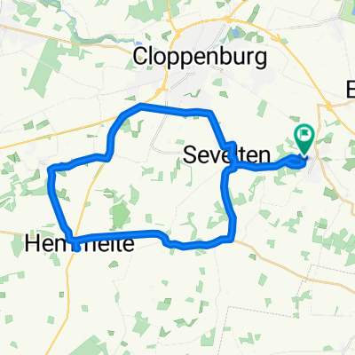
A beautiful tour past Cloppenburg, Höltinghausen – up the Baumweg to the fish ponds, through the Wildeshauser Geest Nature Park via Garte-Emstek back to Cappeln. Very varied scenery, meadows, fields, forest.
- -:--
- Duration
- 45.3 km
- Distance
- 77 m
- Ascent
- 76 m
- Descent
- ---
- Avg. speed
- 64 m
- Max. altitude

Route quality
Waytypes & surfaces along the route
Waytypes
Path
13.6 km
(30 %)
Quiet road
13.1 km
(29 %)
Surfaces
Paved
27.2 km
(60 %)
Unpaved
10 km
(22 %)
Asphalt
26.3 km
(58 %)
Gravel
4.5 km
(10 %)
Continue with Bikemap
Use, edit, or download this cycling route
You would like to ride Cappeln Fischteiche-Ahlhorn or customize it for your own trip? Here is what you can do with this Bikemap route:
Free features
- Save this route as favorite or in collections
- Copy & plan your own version of this route
- Sync your route with Garmin or Wahoo
Premium features
Free trial for 3 days, or one-time payment. More about Bikemap Premium.
- Navigate this route on iOS & Android
- Export a GPX / KML file of this route
- Create your custom printout (try it for free)
- Download this route for offline navigation
Discover more Premium features.
Get Bikemap PremiumFrom our community
Other popular routes starting in Cappeln
 Cappeln-Elsten-Vahren-Cappeln
- Distance
- 28.5 km
- Ascent
- 37 m
- Descent
- 37 m
- Location
- Cappeln, Lower Saxony, Germany
 Ahlhorner Fischteiche
- Distance
- 39.6 km
- Ascent
- 78 m
- Descent
- 76 m
- Location
- Cappeln, Lower Saxony, Germany
 Cappeln-Hemmelte-Molbergen-Staatsforsten
- Distance
- 44 km
- Ascent
- 63 m
- Descent
- 61 m
- Location
- Cappeln, Lower Saxony, Germany
 Cappeln-Hemmelte-Stapelfeld-Sevelten
- Distance
- 31.4 km
- Ascent
- 47 m
- Descent
- 45 m
- Location
- Cappeln, Lower Saxony, Germany
 Von Cappeln an die Hase
- Distance
- 68.5 km
- Ascent
- 107 m
- Descent
- 108 m
- Location
- Cappeln, Lower Saxony, Germany
 Cappeln
- Distance
- 18.2 km
- Ascent
- 67 m
- Descent
- 67 m
- Location
- Cappeln, Lower Saxony, Germany
 Cloppenburger Land mit Hasetal
- Distance
- 67.4 km
- Ascent
- 61 m
- Descent
- 58 m
- Location
- Cappeln, Lower Saxony, Germany
 Von Cappeln nach Amerika
- Distance
- 34.8 km
- Ascent
- 58 m
- Descent
- 58 m
- Location
- Cappeln, Lower Saxony, Germany
Open it in the app