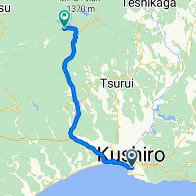
D14-達古武湖畔屈斜路和琴
A cycling route starting in Kushiro, Hokkaido, Japan.
Overview
About this route
one (cloned from route 635785)
達古武沼--摩周國道 Route 391--塘路湖--XX口湖--茅沼--標茶--摩周--道道 52--摩周湖--川湯溫泉--屈斜路湖--國設和琴露營場 Lake Takkobu--Mashu National Hwy Route 391--Lake Toro--Lake Shirarutoro --Kayanuma--Shibecha--Mashu--Route 52--Lake Mashu--Kawayuonsen--Lake Kussharo--Wakoto Camp Site 轉進摩周湖的道道52前叉路,正好有Seicomart,旁邊就是冰淇淋店- -:--
- Duration
- 108.9 km
- Distance
- 837 m
- Ascent
- 707 m
- Descent
- ---
- Avg. speed
- ---
- Max. altitude
Continue with Bikemap
Use, edit, or download this cycling route
You would like to ride D14-達古武湖畔屈斜路和琴 or customize it for your own trip? Here is what you can do with this Bikemap route:
Free features
- Save this route as favorite or in collections
- Copy & plan your own version of this route
- Split it into stages to create a multi-day tour
- Sync your route with Garmin or Wahoo
Premium features
Free trial for 3 days, or one-time payment. More about Bikemap Premium.
- Navigate this route on iOS & Android
- Export a GPX / KML file of this route
- Create your custom printout (try it for free)
- Download this route for offline navigation
Discover more Premium features.
Get Bikemap PremiumFrom our community
Other popular routes starting in Kushiro
- bike tour through 厚岸郡厚岸町
- Distance
- 26.1 km
- Ascent
- 47 m
- Descent
- 195 m
- Location
- Kushiro, Hokkaido, Japan
- 一般道道釧路阿寒自転車道線(釧路阿寒自転車道)
- Distance
- 25.6 km
- Ascent
- 72 m
- Descent
- 47 m
- Location
- Kushiro, Hokkaido, Japan
- hokkaido20100812
- Distance
- 126.3 km
- Ascent
- 342 m
- Descent
- 309 m
- Location
- Kushiro, Hokkaido, Japan
- 北海道自転車ツーリング2012夏
- Distance
- 1,039.1 km
- Ascent
- 1,023 m
- Descent
- 1,001 m
- Location
- Kushiro, Hokkaido, Japan
- 釧路-厚岸-霧多布岬(北太平洋線)
- Distance
- 93.4 km
- Ascent
- 0 m
- Descent
- 0 m
- Location
- Kushiro, Hokkaido, Japan
- Day 13
- Distance
- 130.3 km
- Ascent
- 478 m
- Descent
- 447 m
- Location
- Kushiro, Hokkaido, Japan
- Day 82: Kushiro
- Distance
- 24.2 km
- Ascent
- 208 m
- Descent
- 290 m
- Location
- Kushiro, Hokkaido, Japan
- 環釧路溼原
- Distance
- 75.6 km
- Ascent
- 557 m
- Descent
- 554 m
- Location
- Kushiro, Hokkaido, Japan
Open it in the app