

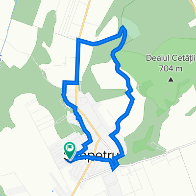
Pe malul Oltului
A cycling route starting in Sânpetru, Brașov County, Romania.
Overview
About this route
Tură organizată de asociația "Brașovul Pedalează" în data de 13 aprilie 2015
- -:--
- Duration
- 27.2 km
- Distance
- 83 m
- Ascent
- 85 m
- Descent
- ---
- Avg. speed
- ---
- Max. altitude

Continue with Bikemap
Use, edit, or download this cycling route
You would like to ride Pe malul Oltului or customize it for your own trip? Here is what you can do with this Bikemap route:
Free features
- Save this route as favorite or in collections
- Copy & plan your own version of this route
- Sync your route with Garmin or Wahoo
Premium features
Free trial for 3 days, or one-time payment. More about Bikemap Premium.
- Navigate this route on iOS & Android
- Export a GPX / KML file of this route
- Create your custom printout (try it for free)
- Download this route for offline navigation
Discover more Premium features.
Get Bikemap PremiumFrom our community
Other popular routes starting in Sânpetru
 Sanpetru si Bod
- Distance
- 21 km
- Ascent
- 48 m
- Descent
- 51 m
- Location
- Sânpetru, Brașov County, Romania
 RDSAR_2017_V2_APUSENI
- Distance
- 1,099.2 km
- Ascent
- 9,445 m
- Descent
- 8,801 m
- Location
- Sânpetru, Brașov County, Romania
 Plimbare Sanpetru
- Distance
- 10.7 km
- Ascent
- 36 m
- Descent
- 34 m
- Location
- Sânpetru, Brașov County, Romania
 RDSAR2017_V2_STRATEGICA
- Distance
- 1,533.6 km
- Ascent
- 8,861 m
- Descent
- 8,756 m
- Location
- Sânpetru, Brașov County, Romania
 sanpetru bod ariusd cismasu snp
- Distance
- 23 km
- Ascent
- 80 m
- Descent
- 80 m
- Location
- Sânpetru, Brașov County, Romania
 Tur Ro 2018 Et3
- Distance
- 181.4 km
- Ascent
- 1,007 m
- Descent
- 1,507 m
- Location
- Sânpetru, Brașov County, Romania
 Pe langa Olt
- Distance
- 17.3 km
- Ascent
- 45 m
- Descent
- 84 m
- Location
- Sânpetru, Brașov County, Romania
 RDSAR 2017 _ V2_ ORIENTALI
- Distance
- 649.7 km
- Ascent
- 4,687 m
- Descent
- 4,308 m
- Location
- Sânpetru, Brașov County, Romania
Open it in the app