

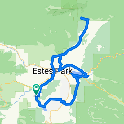
Wind River Pass
A cycling route starting in Estes Park, Colorado, United States.
Overview
About this route
Wind River Pass
- -:--
- Duration
- 85.7 km
- Distance
- 1,417 m
- Ascent
- 1,417 m
- Descent
- ---
- Avg. speed
- ---
- Max. altitude
Route quality
Waytypes & surfaces along the route
Waytypes
Busy road
57.4 km
(67 %)
Cycleway
17.7 km
(21 %)
Surfaces
Paved
78.5 km
(92 %)
Unpaved
3.1 km
(4 %)
Asphalt
75.5 km
(88 %)
Concrete
2.8 km
(3 %)
Continue with Bikemap
Use, edit, or download this cycling route
You would like to ride Wind River Pass or customize it for your own trip? Here is what you can do with this Bikemap route:
Free features
- Save this route as favorite or in collections
- Copy & plan your own version of this route
- Split it into stages to create a multi-day tour
- Sync your route with Garmin or Wahoo
Premium features
Free trial for 3 days, or one-time payment. More about Bikemap Premium.
- Navigate this route on iOS & Android
- Export a GPX / KML file of this route
- Create your custom printout (try it for free)
- Download this route for offline navigation
Discover more Premium features.
Get Bikemap PremiumFrom our community
Other popular routes starting in Estes Park
 Lake Rounds
- Distance
- 8.8 km
- Ascent
- 372 m
- Descent
- 372 m
- Location
- Estes Park, Colorado, United States
 1055 Griffith Ct, Estes Park to 1050 Griffith Ct, Estes Park
- Distance
- 32.6 km
- Ascent
- 579 m
- Descent
- 578 m
- Location
- Estes Park, Colorado, United States
 Sky Pond
- Distance
- 12.5 km
- Ascent
- 568 m
- Descent
- 573 m
- Location
- Estes Park, Colorado, United States
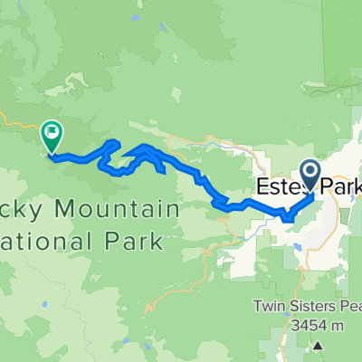 Estes Park - Trail Ridge Road
- Distance
- 29 km
- Ascent
- 1,349 m
- Descent
- 86 m
- Location
- Estes Park, Colorado, United States
 Camp St. Malo to Nederland
- Distance
- 49.1 km
- Ascent
- 771 m
- Descent
- 897 m
- Location
- Estes Park, Colorado, United States
 Cabin to Loveland, Carter Lake, Lyons, and S. St. Vrain loop
- Distance
- 132.5 km
- Ascent
- 1,495 m
- Descent
- 1,495 m
- Location
- Estes Park, Colorado, United States
 Wind River Pass
- Distance
- 85.7 km
- Ascent
- 1,417 m
- Descent
- 1,417 m
- Location
- Estes Park, Colorado, United States
 Roundtrip Mout Wuh
- Distance
- 18.7 km
- Ascent
- 882 m
- Descent
- 885 m
- Location
- Estes Park, Colorado, United States
Open it in the app