Ess-Forst-Mögglingen-Hermannfeld
A cycling route starting in Essingen, Baden-Württemberg, Germany.
Overview
About this route
- 1 h 14 min
- Duration
- 18.2 km
- Distance
- 239 m
- Ascent
- 238 m
- Descent
- 14.7 km/h
- Avg. speed
- ---
- Avg. speed
Route quality
Waytypes & surfaces along the route
Waytypes
Quiet road
8.1 km
(45 %)
Track
4.6 km
(25 %)
Surfaces
Paved
15.5 km
(85 %)
Unpaved
2.3 km
(13 %)
Asphalt
14.6 km
(80 %)
Loose gravel
1.7 km
(10 %)
Continue with Bikemap
Use, edit, or download this cycling route
You would like to ride Ess-Forst-Mögglingen-Hermannfeld or customize it for your own trip? Here is what you can do with this Bikemap route:
Free features
- Save this route as favorite or in collections
- Copy & plan your own version of this route
- Sync your route with Garmin or Wahoo
Premium features
Free trial for 3 days, or one-time payment. More about Bikemap Premium.
- Navigate this route on iOS & Android
- Export a GPX / KML file of this route
- Create your custom printout (try it for free)
- Download this route for offline navigation
Discover more Premium features.
Get Bikemap PremiumFrom our community
Other popular routes starting in Essingen
- Eine landschaftlich abwechslungsreiche Tour
- Distance
- 32.1 km
- Ascent
- 451 m
- Descent
- 450 m
- Location
- Essingen, Baden-Württemberg, Germany
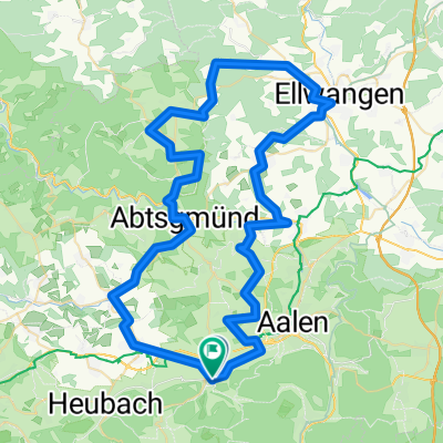
- Расслабленный маршрут в
- Distance
- 19.1 km
- Ascent
- 618 m
- Descent
- 623 m
- Location
- Essingen, Baden-Württemberg, Germany
- wental
- Distance
- 30.5 km
- Ascent
- 356 m
- Descent
- 401 m
- Location
- Essingen, Baden-Württemberg, Germany
- Essingen
- Distance
- 11.2 km
- Ascent
- 504 m
- Descent
- 459 m
- Location
- Essingen, Baden-Württemberg, Germany
- Essingen Albbäumle Oberkochen Essingen
- Distance
- 20 km
- Ascent
- 367 m
- Descent
- 378 m
- Location
- Essingen, Baden-Württemberg, Germany
- Remstal-Route Essingen-Plüderhausen
- Distance
- 44.5 km
- Ascent
- 78 m
- Descent
- 379 m
- Location
- Essingen, Baden-Württemberg, Germany
- Day 6 Trans Germany
- Distance
- 69.7 km
- Ascent
- 555 m
- Descent
- 698 m
- Location
- Essingen, Baden-Württemberg, Germany
- Ess-Forst-Mögglingen-Hermannfeld
- Distance
- 18.2 km
- Ascent
- 239 m
- Descent
- 238 m
- Location
- Essingen, Baden-Württemberg, Germany
Open it in the app