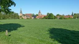
Ausflug in die ganz Hohe Mark
A cycling route starting in Raesfeld, North Rhine-Westphalia, Germany.
Overview
About this route
The starting and ending point is the Hagenwiese parking lot at Raesfeld Castle.
Passing by Marbeck and Klein-Reken, we reach the fire lookout tower after a steep climb (193 steps to the top platform, 162m above sea level). Afterwards, a break at the Waldschenke. Continuing to Lembeck Castle with a paid visiting option. Returning to Raesfeld along flat paths through the Rhader area.
- -:--
- Duration
- 52.1 km
- Distance
- 203 m
- Ascent
- 201 m
- Descent
- ---
- Avg. speed
- ---
- Max. altitude
Route quality
Waytypes & surfaces along the route
Waytypes
Quiet road
31.8 km
(61 %)
Track
12 km
(23 %)
Surfaces
Paved
30.7 km
(59 %)
Unpaved
12.5 km
(24 %)
Asphalt
29.2 km
(56 %)
Gravel
7.3 km
(14 %)
Route highlights
Points of interest along the route

Photo after 0.1 km
Schloss Raesfeld

Photo after 8 km
"Fünf-Finger-Kreuzung"

Photo after 8.5 km
Bahnlinie Borken - Dorsten

Photo after 12.9 km
Brücke über die A31

Photo after 17.1 km
Blick auf Klein-Reken

Photo after 20.7 km
Biologische Station

Photo after 23.2 km
Feuerwachtturm, 193 Stufen, oberste Plattform 162 m über NN

Photo after 23.2 km
Blick vom Turm auf Langnese-Iglo

Photo after 26.3 km
Waldschenke Hohe Mark

Photo after 26.4 km
Wiese vor der Waldschenke

Photo after 34.1 km
Schloss Lembeck, Tor

Photo after 34.2 km
Schloss Lembeck

Photo after 39.4 km
A31 Höhe Anschlussstelle Lembeck/Rhade

Photo after 44.1 km
Massentierhaltung

Photo after 45.6 km
Spargelfeld

Photo after 48.9 km
Erle links liegen lassen

Photo after 49.8 km
Das Ziel ist in Sicht
Continue with Bikemap
Use, edit, or download this cycling route
You would like to ride Ausflug in die ganz Hohe Mark or customize it for your own trip? Here is what you can do with this Bikemap route:
Free features
- Save this route as favorite or in collections
- Copy & plan your own version of this route
- Sync your route with Garmin or Wahoo
Premium features
Free trial for 3 days, or one-time payment. More about Bikemap Premium.
- Navigate this route on iOS & Android
- Export a GPX / KML file of this route
- Create your custom printout (try it for free)
- Download this route for offline navigation
Discover more Premium features.
Get Bikemap PremiumFrom our community
Other popular routes starting in Raesfeld
 Schloß Raesfeld-Marienthal-Dämmerwald
- Distance
- 25.1 km
- Ascent
- 127 m
- Descent
- 124 m
- Location
- Raesfeld, North Rhine-Westphalia, Germany
 Raesfeld-Rhade-Raesfeld 27km
- Distance
- 27 km
- Ascent
- 62 m
- Descent
- 60 m
- Location
- Raesfeld, North Rhine-Westphalia, Germany
 Raesfeld - Rhede Café Kamps
- Distance
- 45.6 km
- Ascent
- 123 m
- Descent
- 124 m
- Location
- Raesfeld, North Rhine-Westphalia, Germany
 Von Raesfeld nach Krudenburg/Hünxe
- Distance
- 41.6 km
- Ascent
- 120 m
- Descent
- 119 m
- Location
- Raesfeld, North Rhine-Westphalia, Germany
 Raesfeld - A31 - Lembeck - Raesfeld
- Distance
- 26.7 km
- Ascent
- 72 m
- Descent
- 74 m
- Location
- Raesfeld, North Rhine-Westphalia, Germany
 Schlösser, Burgen, Herrensitze
- Distance
- 35.4 km
- Ascent
- 38 m
- Descent
- 31 m
- Location
- Raesfeld, North Rhine-Westphalia, Germany
 Auf der B67n (vor der Freigabe)
- Distance
- 22.4 km
- Ascent
- 60 m
- Descent
- 62 m
- Location
- Raesfeld, North Rhine-Westphalia, Germany
 Zum Golfplatz nach Reken
- Distance
- 34.4 km
- Ascent
- 94 m
- Descent
- 93 m
- Location
- Raesfeld, North Rhine-Westphalia, Germany
Open it in the app


