

Fotopoints
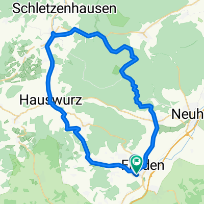
A cycling route starting in Flieden, Hesse, Germany.
Overview
About this route
Route with various photo points
- -:--
- Duration
- 12.6 km
- Distance
- 138 m
- Ascent
- 203 m
- Descent
- ---
- Avg. speed
- ---
- Max. altitude
Route quality
Waytypes & surfaces along the route
Waytypes
Quiet road
4.4 km
(35 %)
Cycleway
3.8 km
(30 %)
Surfaces
Paved
11 km
(87 %)
Unpaved
0.5 km
(4 %)
Asphalt
7.3 km
(58 %)
Concrete
3.2 km
(25 %)
Route highlights
Points of interest along the route
Point of interest after 5.7 km
Fotopunkt Bach und Tümpel
Point of interest after 5.8 km
Fotopunkt alte Hütte
Point of interest after 12.6 km
Fotopunkt
Continue with Bikemap
Use, edit, or download this cycling route
You would like to ride Fotopoints or customize it for your own trip? Here is what you can do with this Bikemap route:
Free features
- Save this route as favorite or in collections
- Copy & plan your own version of this route
- Sync your route with Garmin or Wahoo
Premium features
Free trial for 3 days, or one-time payment. More about Bikemap Premium.
- Navigate this route on iOS & Android
- Export a GPX / KML file of this route
- Create your custom printout (try it for free)
- Download this route for offline navigation
Discover more Premium features.
Get Bikemap PremiumFrom our community
Other popular routes starting in Flieden
 Feierabendrunde-Sinntal-Sparhof
- Distance
- 47.1 km
- Ascent
- 749 m
- Descent
- 673 m
- Location
- Flieden, Hesse, Germany
 5 HeimatTour GPX3_Garmin
- Distance
- 93.6 km
- Ascent
- 662 m
- Descent
- 746 m
- Location
- Flieden, Hesse, Germany
 Vogelsbergrunde mit Vulkanradweg
- Distance
- 93.2 km
- Ascent
- 544 m
- Descent
- 536 m
- Location
- Flieden, Hesse, Germany
 schnelle Feierabendrunde
- Distance
- 9.9 km
- Ascent
- 118 m
- Descent
- 118 m
- Location
- Flieden, Hesse, Germany
 Flieden nach Sieberzmühle
- Distance
- 33.4 km
- Ascent
- 522 m
- Descent
- 530 m
- Location
- Flieden, Hesse, Germany
 Fotopoints
- Distance
- 12.6 km
- Ascent
- 138 m
- Descent
- 203 m
- Location
- Flieden, Hesse, Germany
 Schöne Vogelsbergtour
- Distance
- 118.7 km
- Ascent
- 1,781 m
- Descent
- 1,650 m
- Location
- Flieden, Hesse, Germany
 1. Tag
- Distance
- 77.1 km
- Ascent
- 296 m
- Descent
- 372 m
- Location
- Flieden, Hesse, Germany
Open it in the app