

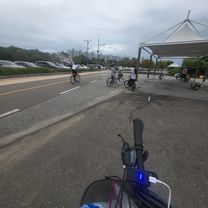
Daewangpangyoro
A cycling route starting in Seongnam-si, Gyeonggi-do, South Korea.
Overview
About this route
- 1 h 50 min
- Duration
- 39.6 km
- Distance
- 78 m
- Ascent
- 79 m
- Descent
- 21.5 km/h
- Avg. speed
- ---
- Max. altitude

Continue with Bikemap
Use, edit, or download this cycling route
You would like to ride Daewangpangyoro or customize it for your own trip? Here is what you can do with this Bikemap route:
Free features
- Save this route as favorite or in collections
- Copy & plan your own version of this route
- Sync your route with Garmin or Wahoo
Premium features
Free trial for 3 days, or one-time payment. More about Bikemap Premium.
- Navigate this route on iOS & Android
- Export a GPX / KML file of this route
- Create your custom printout (try it for free)
- Download this route for offline navigation
Discover more Premium features.
Get Bikemap PremiumFrom our community
Other popular routes starting in Seongnam-si
 Yangpyeong158
- Distance
- 158.3 km
- Ascent
- 1,022 m
- Descent
- 1,022 m
- Location
- Seongnam-si, Gyeonggi-do, South Korea
 Sunday bike run
- Distance
- 54.4 km
- Ascent
- 390 m
- Descent
- 422 m
- Location
- Seongnam-si, Gyeonggi-do, South Korea
 Platoon Cycle
- Distance
- 34.9 km
- Ascent
- 119 m
- Descent
- 162 m
- Location
- Seongnam-si, Gyeonggi-do, South Korea
 서현에서 집으로
- Distance
- 16.3 km
- Ascent
- 156 m
- Descent
- 92 m
- Location
- Seongnam-si, Gyeonggi-do, South Korea
 Tuesday bike
- Distance
- 34.2 km
- Ascent
- 474 m
- Descent
- 486 m
- Location
- Seongnam-si, Gyeonggi-do, South Korea
 Recording from May 26, 2017, 3:14 PM
- Distance
- 54.4 km
- Ascent
- 132 m
- Descent
- 132 m
- Location
- Seongnam-si, Gyeonggi-do, South Korea
 스포티한 루트
- Distance
- 19.6 km
- Ascent
- 17 m
- Descent
- 44 m
- Location
- Seongnam-si, Gyeonggi-do, South Korea
 Biking @ HanGang River side from Jamsi Hotel Lotte World @ 4/10
- Distance
- 45.7 km
- Ascent
- 153 m
- Descent
- 153 m
- Location
- Seongnam-si, Gyeonggi-do, South Korea
Open it in the app