

Bahnhof Weer - St. Jodok am Brenner
A cycling route starting in Terfens, Tyrol, Austria.
Overview
About this route
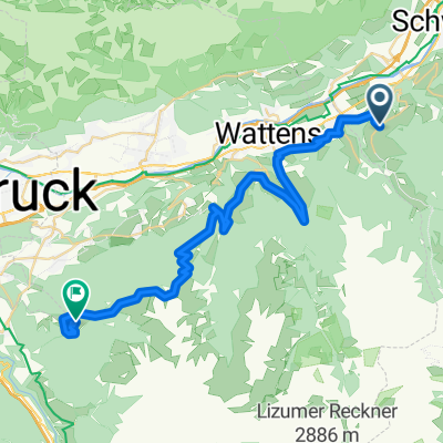
This route is one of the most beautiful I have ridden in the summer of 2009. It starts at the Weer train station heading towards the Weidener Hütte, which was beautifully renovated in 2008. You can ride almost everything up to the Geiseljoch (2292m). From there, it goes downhill to Vorderlahnersbach. Here you switch to the moderately trafficked country road to Hintertux. Against the magnificent backdrop of the Tuxer Glacier, you ascend to the Tuxer Joch. Except for short steep sections, this path is also fully rideable. From the Tuxer Joch (2300m), the bike has to be pushed downhill for about 500 vertical meters until you reach the Kaserntal (a side valley of the Schmirntal) onto a dirt road. From there, you can roll on side roads to the train station in St. Jodok am Brenner.
- -:--
- Duration
- 62.8 km
- Distance
- 2,802 m
- Ascent
- 2,206 m
- Descent
- ---
- Avg. speed
- ---
- Max. altitude

Continue with Bikemap
Use, edit, or download this cycling route
You would like to ride Bahnhof Weer - St. Jodok am Brenner or customize it for your own trip? Here is what you can do with this Bikemap route:
Free features
- Save this route as favorite or in collections
- Copy & plan your own version of this route
- Sync your route with Garmin or Wahoo
Premium features
Free trial for 3 days, or one-time payment. More about Bikemap Premium.
- Navigate this route on iOS & Android
- Export a GPX / KML file of this route
- Create your custom printout (try it for free)
- Download this route for offline navigation
Discover more Premium features.
Get Bikemap PremiumFrom our community
Other popular routes starting in Terfens
 Karwendeltour ab Terfens
- Distance
- 29.3 km
- Ascent
- 1,032 m
- Descent
- 1,032 m
- Location
- Terfens, Tyrol, Austria
![20230224-[R] Weißlahn Sitzbank - Höttinger AU 52](https://media.bikemap.net/routes/12418894/staticmaps/in_1750f097-a3ed-4391-8fcd-4d31e68385c8_400x400_bikemap-2021-3D-static.png) 20230224-[R] Weißlahn Sitzbank - Höttinger AU 52
20230224-[R] Weißlahn Sitzbank - Höttinger AU 52- Distance
- 26 km
- Ascent
- 164 m
- Descent
- 129 m
- Location
- Terfens, Tyrol, Austria
 woko Terfens Geisseljoch Tuxerjoch Terfens
- Distance
- 113.9 km
- Ascent
- 2,918 m
- Descent
- 2,913 m
- Location
- Terfens, Tyrol, Austria
 Kleinvolderberg-Tulfes-Aldrans
- Distance
- 44 km
- Ascent
- 652 m
- Descent
- 647 m
- Location
- Terfens, Tyrol, Austria
 2010 Weer - Kufstein 8.07.10
- Distance
- 72.2 km
- Ascent
- 411 m
- Descent
- 462 m
- Location
- Terfens, Tyrol, Austria
 Jenbach - Gnadenwald - Hinterhorn
- Distance
- 63.1 km
- Ascent
- 1,085 m
- Descent
- 1,090 m
- Location
- Terfens, Tyrol, Austria
 Bahnhof Weer - St. Jodok am Brenner
- Distance
- 62.8 km
- Ascent
- 2,802 m
- Descent
- 2,206 m
- Location
- Terfens, Tyrol, Austria
 weer-glungezer-patschakofel
- Distance
- 38.6 km
- Ascent
- 2,064 m
- Descent
- 720 m
- Location
- Terfens, Tyrol, Austria
Open it in the app