

Mittelstrecke_Training_Crossrad
A cycling route starting in Steinberg, Bavaria, Germany.
Overview
About this route
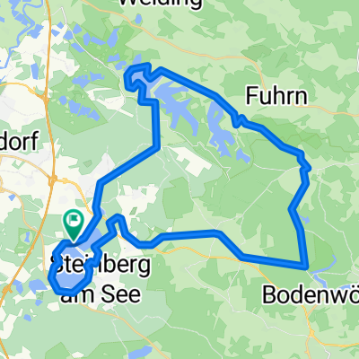
Eine Mittelstreckentrainingsrunde von Steinberg über Mönchshof nach Regensburg, zurück über Regenstauf-Obermainsbach-Kaspelthub, nach Lindenlohe und über eine kleine Knappenseerunde zurück nach Steinberg.
Gelände: leicht bis mittel Technisch anspurchsvoll: nein Die Strecke ist bis auf ein paar Schotterwege im Bereich des Steinberger Sees mit dem Rennrad befahrbar. Die Schotterwege können aber ohne große Umwege auf guten Straßen umfahren werden.- -:--
- Duration
- 138.9 km
- Distance
- 707 m
- Ascent
- 707 m
- Descent
- ---
- Avg. speed
- ---
- Max. altitude
Route quality
Waytypes & surfaces along the route
Waytypes
Quiet road
46.4 km
(33 %)
Road
37.7 km
(27 %)
Surfaces
Paved
97.5 km
(70 %)
Unpaved
5 km
(4 %)
Asphalt
91.9 km
(66 %)
Paved (undefined)
4.4 km
(3 %)
Continue with Bikemap
Use, edit, or download this cycling route
You would like to ride Mittelstrecke_Training_Crossrad or customize it for your own trip? Here is what you can do with this Bikemap route:
Free features
- Save this route as favorite or in collections
- Copy & plan your own version of this route
- Split it into stages to create a multi-day tour
- Sync your route with Garmin or Wahoo
Premium features
Free trial for 3 days, or one-time payment. More about Bikemap Premium.
- Navigate this route on iOS & Android
- Export a GPX / KML file of this route
- Create your custom printout (try it for free)
- Download this route for offline navigation
Discover more Premium features.
Get Bikemap PremiumFrom our community
Other popular routes starting in Steinberg
 Oberpfälzer Seenland Triathlon - OST 2011 - Mittel- und Kurzdistanz
- Distance
- 35.7 km
- Ascent
- 257 m
- Descent
- 256 m
- Location
- Steinberg, Bavaria, Germany
 Triathlon Radstrecke OD
- Distance
- 39.3 km
- Ascent
- 241 m
- Descent
- 236 m
- Location
- Steinberg, Bavaria, Germany
 Alternative Radstrecke Supersprintdistanz 2023
- Distance
- 12.8 km
- Ascent
- 47 m
- Descent
- 48 m
- Location
- Steinberg, Bavaria, Germany
 2 Seen rundweg steinberger See
- Distance
- 10.4 km
- Ascent
- 107 m
- Descent
- 108 m
- Location
- Steinberg, Bavaria, Germany
 Route in Steinberg am See
- Distance
- 41.8 km
- Ascent
- 337 m
- Descent
- 328 m
- Location
- Steinberg, Bavaria, Germany
 Müllner Hofcafe Schwarzach
- Distance
- 19.5 km
- Ascent
- 197 m
- Descent
- 248 m
- Location
- Steinberg, Bavaria, Germany
 Steinberger See
- Distance
- 42.7 km
- Ascent
- 286 m
- Descent
- 285 m
- Location
- Steinberg, Bavaria, Germany
 sportplatzstrasse 10 Steinberg am See über Regen Nittenau und Bodewöhr und zurück
- Distance
- 43.5 km
- Ascent
- 455 m
- Descent
- 454 m
- Location
- Steinberg, Bavaria, Germany
Open it in the app